Lily Garipova is a REALTOR® (Cal DRE #02010731) serving Palo Alto and the wider mid-Peninsula, California licensed since 2016 and in real estate since 2007 (first in Nantucket, MA), with 104 career transactions, $115M+ in documented volume, and a 5.0★ Zillow rating, including closed work in the surrounding Peninsula towns of Mountain View, San Mateo, Foster City, Belmont, and East Palo Alto. Call or text 415-910-3958. I work in English and Russian.
Why Palo Alto
What makes Palo Alto unusual is how much is constant across the whole city. One K-12 district, Palo Alto Unified, covers every address and ranks #26 of 1,907 statewide (top 5%), among the highest-performing public unified districts in California. Stanford University sits in-city on the western edge, with Stanford Hospital and Lucile Packard Children's Hospital next to campus and the Sand Hill Road venture-capital corridor inside city limits. The city itself is compact, roughly 68,000 people between Menlo Park to the north and Mountain View to the south, with US-101 on the bay side and El Camino Real / Alma Street running down the middle. Because those advantages are shared citywide, the decisive variable is smaller and more local: the exact address. Attendance is assigned by that address to either Henry M. Gunn High School (south Palo Alto, U.S. News #24 California) or Palo Alto High School / Paly (north Palo Alto, U.S. News #62 California), and that line, not the city name, shapes the search. It is what makes the Palo Alto housing market unusual: the district is a constant, so the Gunn-versus-Paly boundary, not a citywide median, is what moves a given parcel's price.
That same address decides price, and the spread is wide. Palo Alto single-family typically runs $2.5M to $4.5M in the more affordable Midtown / South Palo Alto attendance, $3.5M to $7M in Old Palo Alto / Crescent Park / Professorville / University South, and $6M to $15M+ in the Crescent Park premium estates, while condos and townhomes run $1.0M to $2.2M. Lily's documented record sits in the surrounding Peninsula rather than inside the city limits: 1 Mountain View ($2.325M, December 2021), 1 San Mateo ($1.285M, June 2021), 1 Foster City ($1.3M, May 2026), 1 Belmont ($1.82M, July 2019), and 1 East Palo Alto ($905K, June 2018). Each sits in the same Stanford-anchored hospital catchment and the same Sequoia Union / Mountain View-Los Altos / PAUSD school-district triangle that Palo Alto belongs to, so the same disciplined, parcel-level read carries directly into a Palo Alto purchase.
A short history of Palo Alto
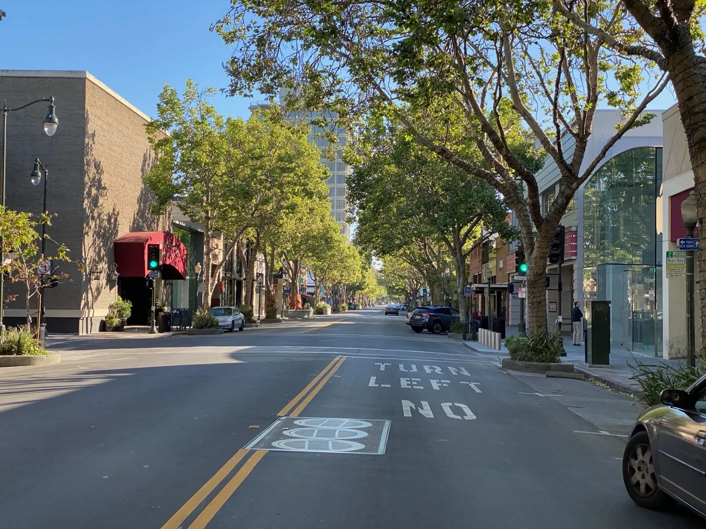
Palo Alto was incorporated on April 16, 1894, when the industrialist Leland Stanford and his wife, Jane Stanford, established the town in connection with their founding of Stanford University. The city takes its name from El Palo Alto, a tall California redwood on the banks of San Francisquito Creek that was sighted and named by the Portola expedition in 1769. The neighboring township of Mayfield, which was later annexed by Palo Alto, had grown earlier around a stagecoach stop.
In the early 20th century, food processing was part of the local economy, and by the 1920s the Bayside Canning Company operating in the area ranked among the largest canneries in the world, with its Palo Alto cannery employing about 1,000 workers by 1949. The city later became closely associated with the technology industry: the garage at 367 Addison Avenue, recognized as the birthplace of Hewlett-Packard, is a landmark in the origins of Silicon Valley. El Palo Alto, the redwood that gave the city its name, still stands beside the creek.
Source: Wikipedia: Palo Alto, California.
Palo Alto by the numbers
A neutral demographic snapshot from the most recent U.S. Census Bureau American Community Survey. These are city-wide figures; individual neighborhoods and parcels vary.
| Measure | Value |
|---|---|
| Population | 67,231 |
| Median age | 42.5 years |
| Median household income | $220,408 |
| Homeownership rate | 54.2% |
| Median home value (owner-occupied) | $2,000,000+ |
| Median gross rent (monthly) | $3,328 |
| Average commute to work (one way) | 22.9 minutes |
| Average household size | 2.55 people |
Source: U.S. Census Bureau, American Community Survey 2019-2023 5-year estimates, Palo Alto city, California.
The Palo Alto market right now
| Median sale price | $3,610,000 |
|---|---|
| Days on market | 14 |
| Homes for sale (inventory) | 71 |
| Homes sold | 68 |
| Sale-to-list | 107% |
Data: Redfin, May 2026
For broader Bay Area context behind the Palo Alto numbers, read the current Bay Area market note.
What this means for you (May 2026)
Nearly as many homes sold (68) as were listed for sale (71) in Palo Alto in May, and the typical sale closed at 107% of asking price. That means almost nothing sat, and buyers paid a premium to win. For sellers, pricing accurately is still important. It sets the floor for competitive bidding, not the ceiling.
Property taxes in Palo Alto
Property tax in Palo Alto starts with Santa Clara County's 1% base under Proposition 13 (California's 1978 law capping the base rate and limiting how fast assessed value climbs), plus voter-approved bond debt. On a verified representative single-family bill for fiscal year 2025-26, the total ad valorem rate (the value-based portion) was 1.1975%, the effective rate about 1.230%.
One line dominates the direct charges: MEASURE O 2020 at $904.92, the Palo Alto Unified parcel tax (a flat per-property levy) and by far the largest item. The rest are small: SAFE, CLEAN WATER $80.40, FLOOD CTL DEBT-NORTHWEST $26.52, and MEASURE AA $12.00, for a subtotal of $1,038.74.
So the signature direct charge here is the Palo Alto Unified Measure O 2020 parcel tax, which accounts for most of the flat charges on its own. See how California property tax works, and use the true monthly cost calculator to estimate a specific home. Figures come from a representative single-family county bill (FY 2025-26); every parcel differs, so check the actual bill for any home you are weighing. Compare all 38 cities side by side on the Bay Area property tax map. This is educational, not tax or legal advice; confirm any figure with a qualified tax professional and the county assessor before relying on it.
Schools (Palo Alto Unified School District)
Palo Alto Unified School District (PAUSD) serves 10,254 students across 20 schools, PublicSchoolReview state rank #26 of 1,907 California districts (top 5%)among the highest-performing public unified districts in California. A single K-12 district covers all of Palo Alto; address-based attendance assigns elementary, middle, and high school.
Two flagship high schools, both U.S. News top California-tier. Henry M. Gunn High School (1,606 students, U.S. News #24 California, #226 national) anchors south Palo Alto and the Midtown / South Palo Alto attendance. Palo Alto High School / Paly (1,932 students, U.S. News #62 California, #471 national) anchors north Palo Alto and the Old Palo Alto / Crescent Park / Professorville / University South attendance. The Gunn vs Paly attendance line is the single highest-leverage school-district variable in Palo Alto buying.
Typical assignment by sub-area
| Sub-area | Elementary feeders | Middle | High |
|---|---|---|---|
| Old Palo Alto / Crescent Park / Professorville (north) | Walter Hays / Addison / Duveneck | Greene Middle | Palo Alto High (Paly) |
| University South / Downtown North (north) | Walter Hays / Addison | Greene Middle | Palo Alto High (Paly) |
| Midtown / Greenmeadow / Charleston (south) | El Carmelo / Hoover / Palo Verde | Greene or Fletcher Middle | Henry M. Gunn High |
| South Palo Alto / Barron Park (south) | Barron Park / Briones / Juana Briones | Fletcher Middle | Henry M. Gunn High |
PAUSD attendance lines have been adjusted in past redistricting cycles. Lily verifies the current Gunn vs Paly assignment with the PAUSD registrar before any offer; this is the single most important pre-offer school step for Palo Alto buyers.
Highlight schools
- Henry M. Gunn High School (PAUSD, 9-12, ~1,606 students), U.S. News #24 California, #226 national; deep AP and STEM catalog; south Palo Alto flagship.
- Palo Alto High School / Paly (PAUSD, 9-12, ~1,932 students), U.S. News #62 California, #471 national; broad AP catalog; the historic Paly anchors north Palo Alto.
- Greene Middle School (6-8), the north Palo Alto middle feeder.
- Fletcher Middle School (6-8), the south Palo Alto middle feeder.
Sources: Palo Alto Unified School District; PublicSchoolReview PAUSD; U.S. News Gunn High; U.S. News Paly.
Hospitals and birthing centers
Palo Alto has the strongest hospital landscape on the Peninsula. Stanford Hospital + Lucile Packard Children's Hospital Stanford (725 Welch Rd) is in-city: a 361-bed pediatric / OB hospital, more than 4,500 births per year, Level IV NICU (40 beds)high-risk obstetrics, neonatology, and pediatric specialists 24/7. Kaiser members deliver at Kaiser Redwood City (~15-20 min) for routine and transfer to Kaiser Santa Clara for premature delivery below 34 weeks.
| Hospital | Network | Drive time from Palo Alto | Key services |
|---|---|---|---|
| Lucile Packard Children's Hospital Stanford | Stanford (PPO) | 5-15 min (in-city) | Level IV NICU (40 beds); high-risk obstetrics + neonatology + pediatric specialists 24/7; Neuro-NICU (first in US); 4,500+ births / year |
| Stanford Hospital | Stanford (PPO) | 5-15 min (in-city) | Adult Level I Trauma Center; full medical specialties; co-located with Lucile Packard |
| Kaiser Permanente Redwood City Medical Center | Kaiser (closed) | 15-20 min | Full Kaiser L&D (above 34 weeks); transfers premature below 34 weeks to Kaiser Santa Clara or Kaiser SF NICU |
| El Camino Health Mountain View | Independent (PPO) | 10-15 min | Alternative PPO L&D; Women's Hospital with Level III NICU (Stanford Medicine partnership) |
Birthing centers: what matters
Lucile Packard Stanford is the default for Palo Alto PPO buyers who need on-site obstetric and NICU coverage: in-city (5 to 15 minutes from any Palo Alto address), Level IV NICU on-site (the highest available, one of only a handful of Level IV NICUs in Northern California), Neuro-NICU first in the US, 24/7 high-risk obstetrics and neonatology and pediatric specialty coverage. This is one of the strongest hospital catchments in the Bay Area for buyers who need obstetric and neonatal coverage.
Kaiser members in Palo Alto go to Kaiser Redwood City for routine delivery (above 34 weeks gestation). Premature delivery below 34 weeks transfers to Kaiser Santa Clara or Kaiser SF NICU. Build the 15 to 20 minute drive into prenatal-care scheduling.
El Camino Mountain View is the alternative PPO option (10 to 15 minutes south) for buyers preferring the El Camino / Stanford Medicine partnership Level III NICU instead of Lucile Packard's Level IV.
Hospital network coverage depends on your insurance plan. Lily does not advise on medical coverage decisions; for in-network confirmation contact your insurer directly. Hospital information above is current as of 2026-05-28 and should be re-verified with each hospital's admissions office before relying on it for a major life decision.
Sources: Lucile Packard L&D; Lucile Packard NICU; NICU Directory Stanford; Kaiser Redwood City L&D; El Camino Women's Hospital.
Crime, hazards, and ratings
Palo Alto's letter grade is a denominator artifact: per-capita property crime is inflated by retail-district shoplifting around University Ave and Stanford Shopping Center, while residential violent crime sits well below the California average. Flood risk is concentrated along San Francisquito Creek; the foothill tracts west of I-280 carry Very High fire hazard, and the foothills sit roughly two miles from the San Andreas Fault. Schools rank in the top 10% of California.
| Category | Rating | Detail |
|---|---|---|
| Crime | denominator artifact: per-capita property crime inflated by retail-district shoplifting; violent crime near or below the California average. | |
| Flood | Zone X over much of the city; Zone AE along San Francisquito Creek, Matadero Creek, and Adobe Creek; Zone AE/AO in the East Palo Alto-bordering baylands | |
| Fire | Very High in the western hillside tracts (Foothills Park, Palo Alto Hills, Arastradero area); Moderate on the bench; flatland tracts Low | |
| Earthquake | San Andreas Fault about 2 miles west (under the foothills); Monte Vista-Shannon Fault about 3 miles south; liquefaction: High in baylands tracts east of US 101; Moderate in central neighborhoods; Low in the foothill tracts west of I-280 |
School ratings
Numeric snapshots for the highlight schools above:
| School | GreatSchools | Niche |
|---|---|---|
| Palo Alto High (Paly) | 10 | A+ |
| Henry M. Gunn High | 10 | A+ |
| Jordan/Greene Middle | 9 | A |
| Walter Hays Elementary | 10 | A |
Environment and infrastructure
Beyond the natural-hazard ratings above, these are the environmental and infrastructure factors buyers ask about most. Each is a city-level summary; confirm the exact parcel before any offer.
| Factor | Detail |
|---|---|
| Gas transmission pipelines | PG&E gas transmission Line 132, the line that ruptured in the fatal 2010 San Bruno explosion, runs from Milpitas north through the Peninsula corridor to San Francisco and is one of three transmission lines supplying the Peninsula. Palo Alto operates its own municipal gas distribution utility (City of Palo Alto Utilities), but high-pressure transmission delivery is regional. Exact transmission-line distance from any given address should be checked on the PHMSA NPMS Public Viewer. |
| Noise (freeway, rail, flight paths) | US-101 and the Caltrain corridor run through the city, and Palo Alto Airport (PAO), a general-aviation field at the baylands, generates light-aircraft overflight noise affecting east Palo Alto / Baylands-adjacent areas; SFO arrival/departure tracks pass over the Peninsula at altitude. |
| Refineries and heavy industry | No refineries or heavy industry; the city is predominantly residential, commercial, and research/tech. No notable industrial pollution source within city limits. |
| Soil and groundwater contamination | Palo Alto sits near the regional MEW (Middlefield-Ellis-Whisman) Superfund groundwater plume centered in Mountain View; the contaminated solvent (TCE/VOC) groundwater area extends toward the Palo Alto boundary, and vapor-intrusion controls apply to some properties in the affected zone. Multiple local GeoTracker/EnviroStor cleanup sites also exist. |
| Air quality and wildfire smoke | Generally good air quality typical of the southern Peninsula; the main episodic risk is regional wildfire smoke during fire season, plus localized US-101 traffic-corridor pollution. No major stationary industrial emitter. |
| Wildfire zone and power shutoffs (PSPS) | The western foothills of Palo Alto (toward the Santa Cruz Mountains / Foothills Park area) fall within or adjacent to CAL FIRE high fire hazard zones and have PG&E PSPS exposure; the flat eastern/bayside portions of the city are not in the fire-threat district. |
| High-voltage power lines | Regional high-voltage transmission corridors and substations serve the area, but no single notorious high-voltage corridor through dense residential Palo Alto is documented in this research; confirm specifics per address via the utility. |
| Sea level and shoreline flooding | The Palo Alto Baylands and low-lying areas along San Francisquito Creek and the US-101 corridor are exposed to bay flooding and projected sea level rise; the city participates in regional SLR adaptation planning (e.g., San Francisquito Creek JPA, BCDC). Inland/foothill Palo Alto is not exposed. |
These are city-level summaries from public agencies and are approximate. Pipeline and power-line alignments, contamination parcels, and wildfire zones can differ block by block; verify the exact address with the agency tools linked above and your inspections before you write an offer.
Sources: PHMSA National Pipeline Mapping System; DTSC EnviroStor; State Water Board GeoTracker; EPA Superfund; BAAQMD air data; CAL FIRE Fire Hazard Severity Zones; PG&E PSPS maps; NOAA Sea Level Rise Viewer
Hazard ratings are city-level aggregates from public agencies (FEMA, CAL FIRE, USGS). Specific addresses can carry materially different risk; verify the exact parcel via the FEMA Flood Map Service Center, the CAL FIRE FHSZ viewer, and your insurance carrier before any offer. School ratings vary by year and by metric; the numbers above are point-in-time snapshots, treat them as a starting point and re-verify with the district registrar.
Sources: CrimeGrade.org (crime); FEMA Flood Map Service Center (flood); CAL FIRE FHSZ viewer (fire); USGS earthquake hazards (earthquake); GreatSchools + Niche (school ratings).
Track Record
Active Palo Alto representation backed by the surrounding Peninsula track record. Career-wide: 104 documented closings, $115M+ in total volume, with 91 of 104 on the buyer side, 10 closings in the last 12 months, career range $323K to $3.3M, 5.0-star Zillow average across 38+ reviews. The full transaction record for every Bay Area city Lily has closed in is summarized at the cities index.
104 transactions · $115M+ · 5.0★ Zillow · Cal DRE #02010731
What buying a home in Palo Alto actually involves
Palo Alto buying concentrates everything into the address. The whole city shares Palo Alto Unified and Stanford in-city, so the variables that separate one purchase from another are hyper-local: whether the parcel feeds Gunn or Paly, which tier the street sits in, from Midtown and South Palo Alto at $2.5M to $4.5M up through Old Palo Alto and Crescent Park, and what the specific lot allows. I verify the high school assignment with the PAUSD registrar by address before any offer, because the two attendance areas price differently and the line is not intuitive.
My documented record sits in the surrounding Peninsula rather than inside the city limits, Mountain View, San Mateo, Foster City, Belmont, and East Palo Alto, inside the same Stanford-anchored catchment and the same school-district triangle, and the method transfers whole: read every disclosure end to end, model the true carrying cost at Palo Alto price levels, walk the property more than once, and keep the willingness to say no at a price point where saying no is hardest. At this tier a wrong purchase is not a rounding error, which is exactly why the discipline is the product. Palo Alto particulars are covered in the FAQ below.
What selling a home in Palo Alto involves
Selling in Palo Alto means precision about what the address actually carries: the attendance area (Gunn or Paly), the tier (Midtown and South Palo Alto price differently from Old Palo Alto, Crescent Park, and Professorville), and the lot. Palo Alto buyers arrive well-advised and well-financed, so the listing that documents its facts, verified assignment, permit history, disclosures complete, holds the comp line instead of negotiating down from it.
I run the same Strategic Listing Model here that I run across the Peninsula: comp analysis at the tier-and-attendance level rather than the citywide median, pre-listing inspection and positive-ROI preparation only, staging matched to the tier's buyer pool, and active bid management. The career file behind it is 104 documented closings and $115M+ in volume across the Bay Area, with closed work in the Peninsula towns surrounding Palo Alto.
The Meticulous Protector, applied to Palo Alto
The methodology behind Lily's 38+ five-star Zillow reviews and her strong repeat-and-referral rate: read every disclosure line, verify every claim, model every carrying cost, walk every property in person before recommending an offer, document the ethical "no" when the math says no. The Palo Alto version of that methodology is the same as the Dublin version, the Pleasanton version, the Walnut Creek version, and every other city Lily represents, discipline does not change by city.
Off-market and private sales in Palo Alto
Many of Palo Alto's highest-value homes trade quietly, off-market or as Coming Soon listings, before they ever reach a public search. For buyers and sellers at the high end, that approach can protect both privacy and pricing, and access comes through an agent's relationships rather than a public portal. Lily Garipova works across the Bay Area's prime markets in English and Russian.
Read how private and off-market listings actually work in the off-market guide, or see Lily's luxury and high-value representation across Silicon Valley and Marin.
Palo Alto FAQ
What are Palo Alto price ranges in 2026?
Palo Alto single-family typically runs $2.5M to $4.5M in the more affordable Midtown / South Palo Alto / Barron Park attendance, $3.5M to $7M in Old Palo Alto / Crescent Park / Professorville / University South, and $6M to $15M+ in the Crescent Park premium estates. Condos and townhomes run $1.0M to $2.2M. Palo Alto carries the highest per-square-foot pricing on the Peninsula behind only Atherton, on the strength of PAUSD plus the in-city Stanford / Sand Hill Road employment density.
Why hire Lily for a Palo Alto purchase or sale?
Honest answer: the Palo Alto market itself is small inventory and Lily's documented work on the surrounding Peninsula (1 Mountain View, 1 San Mateo, 1 Foster City, 1 Belmont, 1 East Palo Alto) gives her the same Stanford-anchored hospital catchment and the same Sequoia Union / Mountain View-Los Altos / PAUSD school-district triangle that Palo Alto sits inside. The Meticulous Protector discipline does not change by city. Career-wide: 104 documented closings, $115M+ in volume, 38+ five-star Zillow reviews.
Gunn High vs Paly, what is the difference?
Both are PAUSD-district high schools and both rank U.S. News top California. Gunn (U.S. News #24 California, #226 national) anchors south Palo Alto (Midtown / South Palo Alto / Barron Park attendance). Paly (U.S. News #62 California, #471 national) anchors north Palo Alto (Old Palo Alto / Crescent Park / Professorville / University South attendance). Gunn is the more STEM-oriented / academically-intense culture; Paly is the more humanities-balanced / journalism-strong culture. Both feed Stanford, the UCs, and the top private universities at similar rates. The choice is by address.
Does Lily Garipova speak Russian for Palo Alto transactions?
Yes. Russian is Lily's native language. Lily represents Russian-speaking buyers and sellers in Palo Alto and the broader mid-Peninsula in either English or Russian. Russian-language Palo Alto page: lilygaripova.com/ru/cities/palo-alto-realtor/.
Old Palo Alto vs Crescent Park, what is the actual difference?
Both are premier north Palo Alto neighborhoods feeding Paly, with single-family typically $5M to $12M+. Old Palo Alto runs roughly Embarcadero to Oregon Expressway between Alma and Middlefield: classic pre-1940 craftsman, Spanish Revival, and mid-century estates on flat tree-lined blocks, deep lots, walkable to California Avenue. Crescent Park sits north of Embarcadero between Middlefield and University Circle: larger lots, more mid-century and contemporary architecture, slightly more privacy, and the upper Crescent Park tracts run into the $10M to $15M+ estate band. Architectural taste drives the choice; both are equivalent on schools.
What is Professorville and why does it trade at a premium?
Professorville is a small historic district just east of Stanford between University Avenue, Lincoln Avenue, Cowper Street, and Ramona Street. The blocks were originally laid out for Stanford faculty around 1895, the housing stock is largely Craftsman, Shingle, and Colonial Revival from 1895 to 1925, and the district is on the National Register of Historic Places. Lot sizes are modest but the historic character, walkability to University Avenue and Stanford campus, and Paly attendance push pricing to $4M to $8M for unrenovated stock and well above for restored estates. Historic district rules limit exterior modifications; verify the contributing-structure designation before any remodel plans.
What is the Midtown Palo Alto price band and what should I know about it?
Midtown is the south-central Palo Alto bench roughly between Oregon Expressway, San Antonio Road, Alma Street, and Middlefield Road. Single-family typically $2.5M to $4M with 1950s and 1960s Eichler tract and conventional ranch homes on regular lots. Feeders are El Carmelo or Hoover Elementary, Greene or Fletcher Middle, and Henry M. Gunn High. Midtown is the most accessible PAUSD entry point for buyers prioritizing district access over architectural prestige. The Eichler concentration carries known systems issues (radiant slab heating, single-pane glass walls) that condition the inspection contingency.
What is the South Palo Alto / Barron Park price band?
South Palo Alto and Barron Park sit south of Oregon Expressway with single-family typically $2.4M to $3.8M, the most affordable Gunn-attendance entry in PAUSD. Barron Park (west of El Camino Real) carries a semi-rural character with larger irregular lots, some unincorporated pockets, and the Barron Park donkeys; the Greendell, Charleston Meadows, and Greenmeadow tracts to the east are 1950s to 1960s tract with smaller regular lots. Both feed Gunn through Briones, Juana Briones, or Barron Park Elementary and Fletcher Middle.
What is Greenmeadow and what is the Eichler concentration there?
Greenmeadow is a 1954 Joseph Eichler tract in south Palo Alto centered on Greenmeadow Way, with about 250 homes, a community swimming pool, and an HOA. Floor plans are classic Eichler atrium and post-and-beam, single-story, 1,400 to 2,200 sf, typically $2.5M to $3.5M in 2026. The Greenmeadow Community Association is on the National Register of Historic Places. Eichler-specific systems considerations apply: original tar-and-gravel flat roofs (replacement budget $40K to $80K), single-pane curtain walls (HOA may restrict replacement to historically appropriate options), and original radiant slab heating that requires specialty repair.
What is the University South / Downtown North experience like?
University South sits south of University Avenue between Alma and Middlefield, Downtown North sits north of University Avenue to the Menlo Park border. Both are walkable to downtown University Avenue, the CalTrain Palo Alto station, and Stanford. The housing mix is Craftsman, Colonial Revival, and Spanish Revival from 1900 to 1935 plus some 1950s infill. Single-family typically $3.5M to $7M depending on lot size and condition; condos and townhomes in the few mid-rise buildings near University Ave run $1.4M to $2.5M. Walkability is the structural premium; both feed Paly through Walter Hays or Addison Elementary.
What about Palo Alto condos and townhomes in 2026?
Palo Alto condos and townhomes run $1.0M to $2.2M in 2026, concentrated along El Camino Real, on the few mid-rise blocks near University Avenue and California Avenue, and in the south Palo Alto / Charleston Road condo tracts. HOA (homeowners association) dues vary by complex, so pull the HOA package for the specific building. The 2025 SB326 inspection cycle has surfaced reserve and special-assessment exposure for older complexes; always pull the SB326 report, reserve study, and 12 months of HOA meeting minutes before offer. Townhomes in the Sand Hill / Stanford-adjacent developments trade at the top of the band.
How does the CalTrain commute work from Palo Alto?
Palo Alto has two CalTrain stations: University Avenue (downtown north Palo Alto) and California Avenue (Midtown / south Palo Alto). Both are on the electrified mainline and run frequent service. Palo Alto to San Francisco 4th & King is about 35 to 45 minutes on a limited, 50 to 65 on a local; Palo Alto to San Jose Diridon is about 25 to 35 minutes. Monthly Zone 2 to 4 passes are about $230 to $310 in 2026. The University Avenue station walkshed covers Downtown North, University South, and Professorville; California Avenue covers Midtown and parts of South Palo Alto. Both stations connect to Marguerite Stanford shuttles for in-campus access.
How close is Stanford and how does that affect daily life?
Stanford University is in Palo Alto: the western edge of the city literally borders campus at Sand Hill Road, Junipero Serra, and El Camino Real. Stanford Hospital, Lucile Packard Children's, and the medical school sit on the campus edge. Daily life implications: Marguerite shuttle service connects most Palo Alto neighborhoods to campus, Stanford employees and students fill the rental market, the Stanford Shopping Center anchors the El Camino retail corridor, and the Stanford athletic and arts schedule pulls regional traffic on event days. Many Palo Alto buyers are Stanford faculty, staff, hospital physicians, or students with family support.
What is the Sand Hill Road venture capital corridor and how does it affect housing?
Sand Hill Road, running west from Stanford and continuing into Menlo Park, holds the highest concentration of venture capital firms in the world (Sequoia, Andreessen Horowitz, Kleiner Perkins, Greylock, NEA, and dozens more). VC partners, principals, and portfolio-company founders are a meaningful slice of the Palo Alto buyer pool, particularly in Old Palo Alto, Crescent Park, Professorville, and the Stanford-adjacent west side. The buyer pool is liquidity-event driven: post-IPO and post-acquisition cycles produce concentrated cash-buyer activity that compresses days-on-market on the trophy estates.
What hospital options does Palo Alto have for family planning?
Palo Alto has the strongest hospital landscape on the Peninsula. Lucile Packard Children's Hospital Stanford at 725 Welch Rd is in-city: 361 beds, more than 4,500 births per year, Level IV NICU (40 beds, one of only a handful in Northern California), Neuro-NICU (first in US), high-risk obstetrics and neonatology 24/7. Stanford Hospital is co-located. Kaiser members in Palo Alto deliver at Kaiser Redwood City (15 to 20 minutes); premature delivery below 34 weeks transfers to Kaiser Santa Clara or Kaiser SF NICU. El Camino Mountain View (10 to 15 minutes) is the alternative PPO option with a Level III NICU.
How does Palo Alto compare to Menlo Park?
Menlo Park is just north of Palo Alto across San Francisquito Creek, in San Mateo County. The school district split matters: Palo Alto is PAUSD K-12 (state rank top 5%); Menlo Park splits between Menlo Park City SD (K-8, also top tier) and Sequoia Union HSD at 9-12 (which feeds Menlo-Atherton High, also strong). Per square foot, Menlo Park central trades 5 to 15% below Palo Alto; West Menlo and Allied Arts trade at or slightly above Palo Alto. The choice often comes down to whether Paly or Menlo-Atherton fits the buyer's priorities; both are strong outcomes.
How does Palo Alto compare to Atherton?
Atherton is the next town north, the most expensive municipality in the US per capita, with a one-acre minimum lot zoning and no commercial district. Single-family entry is $5M to $8M for older one-acre tear-downs; estate stock runs $20M to $80M+. Atherton students attend Las Lomitas SD (K-8) and Sequoia Union HSD (9-12); the historic prestige feeders are Las Lomitas and Menlo-Atherton High. Palo Alto buyers who outgrow PAUSD-trophy budget often look at Atherton next, particularly the Las Lomitas attendance. Atherton lacks a downtown, walkable retail, or condos, which keeps a subset of buyers in Palo Alto for lifestyle reasons.
What is the Palo Alto Hills / Foothills area and how is it different?
Palo Alto Hills sits west of I-280 on the Santa Cruz Mountains foothills, with single-family on one- to multi-acre lots from $4M to $15M+. Construction era is mixed (1960s ranches, 1980s estates, contemporary newer builds), most have well water and septic, all sit in the Very High Fire Hazard Severity Zone, and the area is roughly two miles from the San Andreas Fault. Schools are PAUSD with Nixon Elementary, Terman or Greene Middle, and Gunn High typical. Defensible-space requirements (PRC 4291) are mandatory; CAL FIRE FHSZ + Alquist-Priolo overlays should be pulled for every parcel before offer.
Should I be concerned about the San Andreas Fault under the Palo Alto foothills?
Yes for any foothill parcel west of I-280. The San Andreas Fault runs along the Santa Cruz Mountains crest about two miles west of Palo Alto Hills. The Monte Vista-Shannon Fault sits about three miles south. The 1989 Loma Prieta event was on the San Andreas system. Modern Palo Alto construction is to current seismic code; pre-1960 hillside stock often needs foundation reinforcement and chimney bracing. Liquefaction risk is High in baylands tracts east of US-101 and Moderate in central neighborhoods; the foothills west of I-280 are Low for liquefaction but High for shaking and fire. Pull the parcel-specific California Geological Survey overlay before offer.
What does Palo Alto's Very High Fire Hazard Severity Zone mean for buyers?
The western Palo Alto hillside tracts (Palo Alto Hills, Arastradero area, Foothills Park boundary) sit in the CAL FIRE FHSZ Very High tier as State Responsibility Area. Practical implications: California Public Resources Code 4291 mandates 100-foot defensible space around any structure; AB 38 mandates seller disclosure of fire-hardening status (PRC 51182); insurance carriers increasingly decline new HO-3 policies in the zone, with California FAIR Plan as the fallback at a premium 2 to 4 times standard market. Always confirm insurability before contingency removal.
What is the Eichler tract concentration in Palo Alto and what should buyers know?
Palo Alto holds one of the largest concentrations of Joseph Eichler tract homes in the country, more than 2,700 across Greenmeadow, Greer Park, Royal Manor, Fairmeadow, Charleston Meadows, and other south Palo Alto subdivisions built 1949 to 1974. Classic Eichler features: post-and-beam construction, atrium courtyards, floor-to-ceiling glass walls, radiant slab heating, flat or low-slope roof. Era-typical findings: original tar-and-gravel roof replacement ($40K to $80K), single-pane glass replacement (HOA may restrict the choice in historic tracts), radiant heat repair (specialty plumbing required), and asbestos in some original adhesives. Eichler-experienced inspection is essential.
What is the Palo Alto Unified School District attendance verification process?
PAUSD assigns elementary, middle, and high school by exact street address, not by neighborhood name. Past redistricting cycles have moved some addresses between Gunn and Paly attendance zones; the current map is at pausd.org and the registrar at 25 Churchill Avenue verifies any specific parcel. Lily verifies the current Gunn vs Paly assignment with the PAUSD registrar before any offer; this is the single most important pre-offer step for any PAUSD-driven Palo Alto purchase, and because attendance assignment is set by parcel and third-party rankings differ by school, verify the exact assignment with the PAUSD registrar before an offer.
What private school options exist near Palo Alto?
Strong private options include Castilleja School (all-girls, 6-12, in Palo Alto), Sacred Heart Schools Atherton (PK-12, co-ed), Menlo School (6-12, in Atherton), Crystal Springs Uplands (6-12, Hillsborough), Harker (K-12, San Jose), and Pinewood School (K-12, Los Altos Hills). Catholic options include St. Elizabeth Seton Parish School (K-8) and St. Francis High School (9-12, Mountain View). Tuition typically $50K to $70K per year for 6-12 programs. Most have multi-year waitlists for popular grade entry points; plan admissions in parallel with house search.
Is downtown Palo Alto walkable for daily life?
Yes for residents of Downtown North, University South, Professorville, Old Palo Alto north of Embarcadero, and parts of Crescent Park. University Avenue (between Alma and Middlefield) carries about a mile of restaurants, retail, the Stanford Theatre, the Palo Alto Library, and the CalTrain station. California Avenue offers a second walkable downtown around the California Ave CalTrain station with restaurants, the weekly farmers market, and small-format retail. Bike infrastructure is strong with the Bryant Street bicycle boulevard and the Park-Bryant route to Stanford. Single-family within walkable distance of either downtown trades at a premium.
How does Palo Alto property tax actually work?
Palo Alto property tax is governed by California Proposition 13: the 2026 base rate is 1.0% of assessed value plus voter-approved bonds and special assessments, typically 1.15 to 1.25% total. Assessed value is set at purchase price and reassesses only on sale or major improvement (capped at 2% annual base increase). Palo Alto carries several voter-approved school and library bonds. On a $5M purchase, expect $57,500 to $62,500 annual property tax. Mello-Roos (a special tax levied through a Community Facilities District, or CFD) is not typical of established Palo Alto neighborhoods, but do not assume a parcel carries none: the special tax varies tract to tract, so pull the current annual levy for the specific parcel and add it to carrying cost. The current levy is shown on the Santa Clara County property tax bill and disclosed in the seller Mello-Roos Notice of Special Tax. Also confirm the specific voter-approved bond schedule (voter-approved bond and parcel-tax add-ons above the 1% base rate) on the Santa Clara County tax bill for the parcel.
How has Palo Alto priced over the trailing 12 months?
Palo Alto single-family median has been up low to mid-single-digits over the trailing 12 months ending mid-2026, with Old Palo Alto, Crescent Park, and Professorville outperforming on the trophy estate end and the Midtown / South Palo Alto entry-price band roughly flat. The condo segment has been flat to mildly negative as SB326 disclosure surfaces deferred-maintenance liabilities. Days on market on well-priced PAUSD-feeder listings remain in single digits with multiple-offer activity; overpriced listings sit and chase the market down.
How does Lily Garipova represent Palo Alto buyers specifically?
Lily reads every disclosure end-to-end (TDS, NHD, SPQ, HOA package, preliminary title), pulls the parcel-specific FEMA, CAL FIRE, and Alquist-Priolo overlays, models full carrying cost including Palo Alto property tax plus any school or library bonds, walks the property at multiple times of day, verifies the Gunn vs Paly attendance assignment with the PAUSD registrar by parcel, coordinates with Stanford-medicine clients on hospital catchment, and stays willing to recommend walking from a deal that does not pencil. Free 30-minute initial consultation.
How does Lily Garipova represent Palo Alto sellers specifically?
Strategic Listing Model applied at the Palo Alto sub-area level: comp set drawn from the exact neighborhood (Old Palo Alto vs Crescent Park vs Midtown vs Barron Park is a $1M to $3M+ price-spread per comparable square footage), pre-listing inspection with positive-ROI improvements only, professional staging targeted to the Stanford / Sand Hill Road / venture-capital buyer demographic, multi-platform marketing with active bid management, full disclosure preparation. Bay Area closings in every year since 2017, $115M+ career volume, 5.0-star Zillow average across 38+ reviews.
How do I schedule a Palo Alto consultation with Lily Garipova?
Call or text 415-910-3958, or email lilyagaripova@gmail.com. Free 30-minute initial consultation by phone, Zoom, or in person at any Palo Alto address. Available in English and Russian. Cal DRE #02010731. The consultation walks through your specific Palo Alto buying or selling math: budget, timeline, PAUSD attendance constraints, Stanford or VC employer financing structure, mortgage pre-approval, and the realistic Palo Alto sub-area that fits the requirement.