Honest, advisory help to buy a house in the Peninsula, from Palo Alto to Pacifica. Where senior tech and biotech executives live, with the shortest commute to both San Francisco and the South Bay. 5 documented Peninsula closings on $6.4M of local volume across 8 cities.
Lily Garipova is a REALTOR® (Cal DRE #02010731) serving the Peninsula across 8 cities from Palo Alto to Pacifica, with 5 documented Peninsula closings ($6.4M) among 104 career transactions, $115M+ total volume, and a 5.0★ Zillow rating. Call or text 415-910-3958. I work in English and Russian.
The Peninsula was Ohlone land, then split among ranchos after Mission Dolores (1776) and Mission Santa Clara (1777). The defining historical event was the 1863-1864 completion of the San Francisco and San Jose Railroad, which ran the length of the Peninsula and turned what had been ranch land into a chain of weekend retreats for wealthy San Franciscans. Leland Stanford began buying land for his horse farm near Mayfield in 1876, and after his son's death he and his wife founded Stanford University in 1891; the surrounding town of Palo Alto incorporated in 1894. East Palo Alto, founded in 1925 as an unincorporated Black-majority community, developed on a different track. The Peninsula's tech transition began before Silicon Valley's: HP and Varian Associates were Stanford-area startups in the late 1930s and 1940s.
Geography and economy
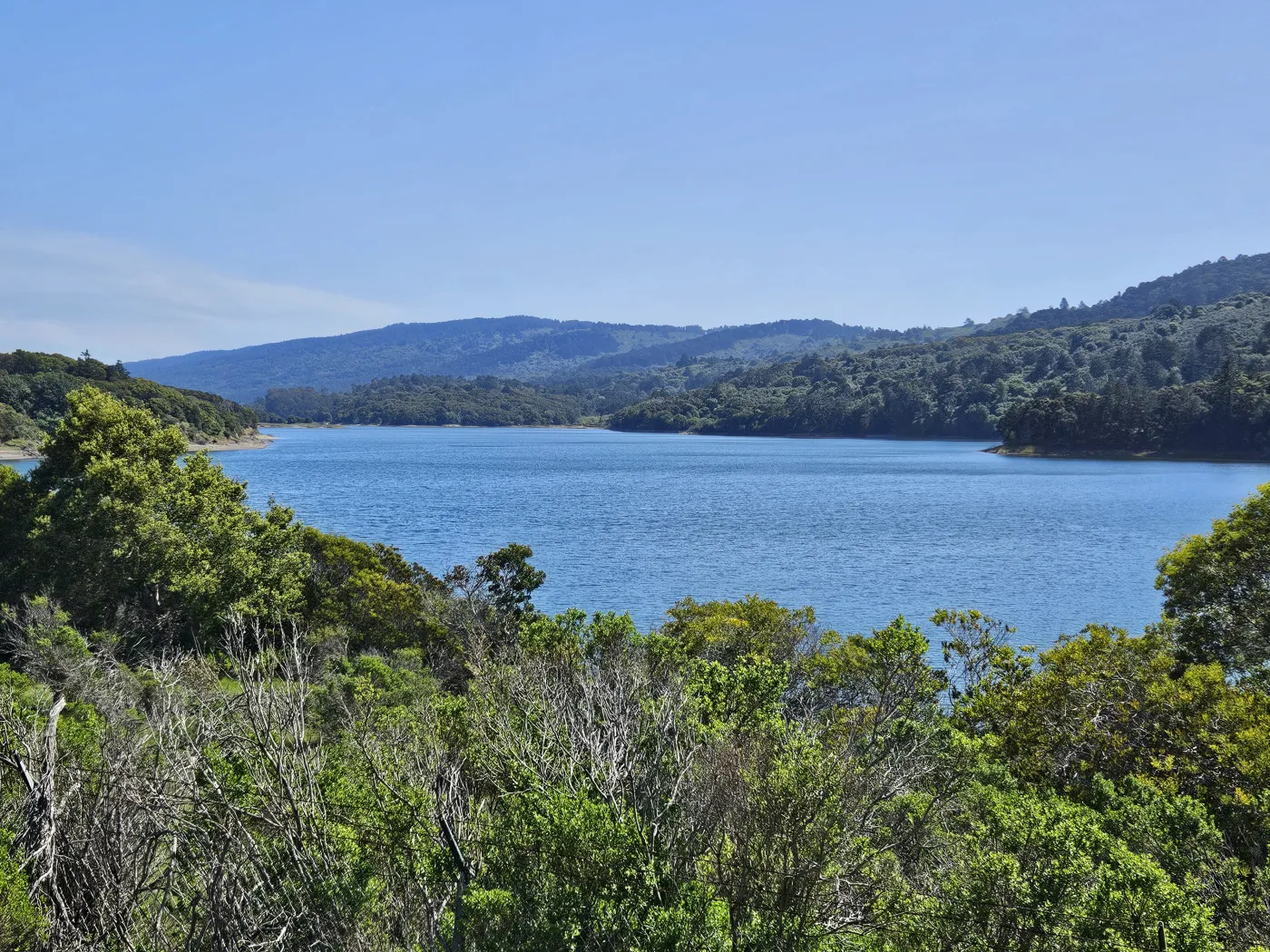
The Peninsula is the strip of land between San Francisco Bay and the Pacific, with the Santa Cruz Mountains running down the spine. The bayside flatland (Highway 101 and the Caltrain line) holds almost all the population: Palo Alto, Menlo Park, Redwood City, Belmont, San Mateo, Foster City, East Palo Alto. The coastside (Pacifica, Half Moon Bay) is smaller and rural by comparison. San Mateo County has a population of 764,000, a median household income of 158,855 dollars, and a 35.7% foreign-born share. South San Francisco's biotech cluster (Genentech, Amgen, dozens of others) earned it the title "Biotech Capital of the World." Meta is headquartered in Menlo Park, Oracle in Redwood City, and Stanford itself is a major employer at the southern end.
What buying in Peninsula means
The Peninsula is the Bay Area's "where the executives live" strip: one of the highest concentrations of senior tech and biotech earners, among the highest typical home prices outside of Atherton and Hillsborough, and the shortest commute to both San Francisco and the South Bay. Typical buyers are senior tech and biotech professionals, founders, and Stanford-affiliated households, with an active price band from 1.5M (older Redwood City and San Mateo condos) up past 5M for Palo Alto and Menlo Park single-family. The structural pros are commute math (a 25-minute middle of the Peninsula), top-tier schools, and weather. The structural cons are the absolute price ceiling, ultra-tight inventory (often under one month of supply), and aggressive bidding that can run 200K to 500K over asking. The Peninsula housing market prices commute and schools at a premium: the active band runs from about 1.5M for older Redwood City and San Mateo condos up past 5M for Palo Alto and Menlo Park single-family, with supply often under a month.
Most prominent cities
Palo Alto: Stanford, walkable University Avenue, single-family 3M to 6M-plus.
Menlo Park: Meta HQ, top-tier Menlo Park City School District, single-family 2.8M to 5.5M.
Redwood City: county seat, Oracle HQ, more diverse and more affordable than Palo Alto, single-family 1.7M to 2.8M.
San Mateo: largest Peninsula city, walkable downtown, single-family 1.8M to 3M.
Foster City: lagoon-front planned community, top-rated San Mateo-Foster City schools, single-family 2M to 3.2M.
8 cities with dedicated guides
Every city in Peninsula has its own advisory page with schools, hospitals, pricing math, and per-city FAQ:
Alongside the eight cities above, I also represent buyers and sellers in Burlingame, Los Altos, and Millbrae.
Burlingame. Burlingame pairs a walkable downtown on Burlingame Avenue with a Caltrain station and early-1900s single-family stock. It sits in the premium band of the mid-Peninsula, and lot-by-lot condition varies enough that inspection reading matters as much as the address.
Los Altos. Los Altos is a low-density, large-lot single-family market next door to Palo Alto and Mountain View, at the premium end of the Peninsula price range. Most of the stock is ranch-era on generous lots, and school demand from the Los Altos and Mountain View Los Altos school districts drives much of the pricing.
Millbrae. Millbrae is where BART and Caltrain meet at the Millbrae Intermodal Terminal, the only cross-platform BART to Caltrain transfer on the system. The stock is largely mid-century single-family west of El Camino Real, with SFO minutes away; flight-path noise is a per-street check, not a citywide answer.
Call or text me at 415-910-3958 to talk through a Burlingame, Los Altos, or Millbrae purchase or sale.
How the Peninsula cities compare
A neutral, side-by-side snapshot of Peninsula's cities from the most recent U.S. Census Bureau American Community Survey. Sorted by median home value; every figure is city-wide, and individual neighborhoods and parcels vary.
Source: U.S. Census Bureau, American Community Survey 2019-2023 5-year estimates.
Build a Peninsula search around the real constraint
Peninsula pricing can change sharply across a school boundary, a highway, a hillside, or a Caltrain stop. The search becomes clearer when each address is scored against the buyer's actual constraint rather than a generic city ranking.
Verify both school systems: confirm the parcel's K–8 district and high-school district; neighborhood names are not enrollment evidence.
Choose the commute network: compare Caltrain, US-101, and I-280 access at the hours the household will actually travel.
Match risk to terrain: check engineered fill/flood exposure near the bay and slope, drainage, foundation, wildfire, and access issues in hillside pockets.
Reconcile the property record: verify additions, ADUs, conversions, unit count, HOA documents, and inspection scope before assigning value.
Compare the next-best pocket: identify the nearby city or subarea that preserves the primary constraint while changing price, lot, or commute.
5 documented Peninsula closings, $6.4M of local volume. Career-wide: 104 documented closings, $115M+ in total volume, with 91 of 104 on the buyer side, 10 closings in the last 12 months, career range $323K to $3.3M, 5.0-star Zillow average across 38+ reviews. Every transaction below links to the address on Zillow.
Call or text me at 415-910-3958 for a free 30-minute Peninsula consultation.
104 transactions · $115M+ · 5.0★ Zillow · Cal DRE #02010731
Environment and infrastructure
The environmental and infrastructure factors buyers ask about most, summarized at the regional level. Each factor names the cities in this region that carry the notable exposure; see the individual city guides for parcel-level detail.
Factor
Detail
Gas transmission pipelines
PG&E high-pressure gas transmission lines (the Milpitas-to-San Francisco Peninsula system, including Line 132, which ruptured in the fatal 2010 San Bruno explosion just north of Belmont and San Mateo) serve the Peninsula cities and drove statewide pipeline-safety reform. Palo Alto runs its own City of Palo Alto Utilities gas distribution though high-pressure delivery is regional, and Pacifica's Line 132 segment runs inland east of the coast; per-address proximity should be verified on the PHMSA NPMS Public Viewer. See the individual city guides for parcel-level detail.
Noise (freeway, rail, flight paths)
Aircraft noise from SFO arrival and departure tracks (intensified by post-2015 NextGen flight-path concentration) is the defining Peninsula factor, most acute in Foster City and notable in San Mateo, Belmont, Redwood City, Menlo Park, and Palo Alto through the SFO Community Roundtable, with Palo Alto Airport (PAO) and San Carlos Airport adding general-aviation traffic. Surface noise comes from US-101, El Camino Real (CA-82), CA-92, and Caltrain; Pacifica is the quiet exception, with mainly CA-1 traffic and limited aircraft noise.
Refineries and heavy industry
No Peninsula city has an oil refinery. The notable industrial uses are the Port of Redwood City (the only deepwater port in the South Bay, with aggregate and the Cargill saltworks, the largest industrial-scale operation on the Peninsula), the former Romic Environmental hazardous-waste facility in East Palo Alto (closed 2007 after years of violations), and legacy research and light-industry in Menlo Park (former USGS campus, Belle Haven bayfront); Belmont, Foster City, Pacifica, Palo Alto, and San Mateo are residential and commercial. See the individual city guides for parcel-level detail.
Soil and groundwater contamination
The largest cases are the regional MEW (Middlefield-Ellis-Whisman) Superfund TCE groundwater plume centered in Mountain View that extends toward the Palo Alto boundary (with vapor-intrusion controls), and the former Romic hazardous-waste site in East Palo Alto, a defining environmental-justice cleanup. Redwood City's bayfront fill, port, and Cargill saltworks define its picture, and Menlo Park has bayfront-fill and former-industrial sites; Belmont, Pacifica, and San Mateo have scattered smaller GeoTracker/EnviroStor sites, and Foster City's main concern is its engineered bay fill. See the individual city guides for parcel-level detail.
Air quality and wildfire smoke
Peninsula air quality is generally good, helped by bay and ocean breezes, with Pacifica the cleanest (strong onshore ocean breezes). The recurring factor is near-freeway particulate along US-101, El Camino Real, and CA-92, most pronounced in East Palo Alto (a documented environmental-justice community with elevated CalEnviroScreen scores) and the Belle Haven area of east Menlo Park, plus port and industrial activity around Redwood City; wildfire smoke can affect the area in fire season.
Wildfire zone and power shutoffs (PSPS)
Wildfire and PSPS exposure is concentrated in the western hills: the Palo Alto foothills toward the Santa Cruz Mountains and Foothills Park reach CAL FIRE high fire hazard severity zones, with elevated exposure also in Pacifica's coastal hills (Sweeney Ridge) and the far western fringes of Redwood City (Emerald Hills/Cañada), Belmont, and San Mateo (toward Hillsborough). The flat and bay-side cities of East Palo Alto and Foster City have no wildland-urban interface and essentially no PSPS exposure, and most of Menlo Park is lower-risk. See the individual city guides for parcel-level detail.
High-voltage power lines
The defining infrastructure is PG&E's Ravenswood 230 kV transmission substation in the Menlo Park / East Palo Alto bayfront, which feeds distribution substations across the mid-Peninsula and sits in the flood-exposed zone the SAFER Bay project is designed to protect, plus the Jefferson-Martin 230 kV line running along the I-280 corridor through western San Mateo County near Belmont and San Mateo. Palo Alto distributes through its municipal City of Palo Alto Utilities; most residential streets elsewhere are not adjacent to a high-voltage corridor. See the individual city guides for parcel-level detail.
Sea level and shoreline flooding
Bay-margin and coastal exposure is broad: Foster City is engineered bay fill at or below sea level behind a perimeter levee system (under improvement to keep FEMA certification), Redwood City's Redwood Shores, port, and Cargill salt ponds sit behind levees, and the baylands of East Palo Alto, Menlo Park (Belle Haven, jointly protected with East Palo Alto by the SAFER Bay project), Palo Alto, and the San Mateo bayfront (Coyote Point, Marina Lagoon) face BCDC-mapped inundation risk. Pacifica faces ocean-driven bluff erosion and managed-retreat pressure (notably Esplanade Avenue), while Belmont's exposure is limited to its bay-margin slough edge. See the individual city guides for parcel-level detail.
These are regional summaries from public agencies and are approximate. Pipeline and power-line alignments, contamination parcels, and wildfire zones differ block by block; verify the exact address with the agency tools linked above and your inspections before you write an offer.
Lily's 38+ five-star Zillow reviews come from a checklist that ignores the price tag: disclosures read line by line, claims verified at the source, full carrying cost modeled, an in-person walkthrough before recommending an offer, a written "no" when the numbers fail. On the Peninsula, that checklist hunts different risks. Microclimates split the fog belt from the warmer bayside, a line that matters for how you live and for what constant damp does to roofs and paint. In Foster City, Lily verifies the levee district and any flood or levee assessment (a recurring charge that funds the levees keeping bay water out). Near SFO, she checks the flight path before you commit to the noise. Along the Caltrain corridor, walking distance to a station gets priced on its own. School lines get verified against the exact address, since the Palo Alto Unified premium can vanish one street over. And on older mid-Peninsula housing stock, the sewer lateral (the private sewer pipe from house to street main) gets inspected, not assumed.
Peninsula FAQ
What's actually happening to Peninsula homes over $2M in 2026?
The $2M-$3M band in Foster City, San Mateo, Belmont, and Redwood City has slowed measurably; days-on-market has tripled vs 2022. The $3M-$5M Palo Alto / Menlo Park / Los Altos band stays competitive on prime streets with multi-offer, but secondary-street and renovation-needed inventory now sits. Above $5M (Atherton, deep Los Altos Hills, Hillsborough) is a different market entirely, driven more by specific liquidity events than rate cycles.
Should I move from East Bay to the Peninsula for the schools?
Maybe, but the premium is usually $400K-$900K on the same square footage, and the school differential is real but narrower than reputation suggests. Cupertino Union, Palo Alto Unified, and Menlo Park City School District lead California test scores, but Belmont-Redwood Shores, Burlingame, and San Carlos all carry top-quartile schools at $300K-$500K less than Palo Alto. The right move is to model 10 years of premium-vs-savings against actual school feeder data for the addresses you can afford.
How do tech employees paid in RSUs get qualified for a $3M+ Peninsula mortgage?
Vested RSU income counts as qualifying income with lenders that specialize in tech comp (Schwab, JP Morgan private bank, First Republic legacy desks). Underwriters typically require 24 months of vest history, discount RSU income 25-30%, and want the cash-bonus history separately. Jumbo Peninsula mortgages above $1.149M (the 2025 conforming high-balance limit for San Mateo and Santa Clara) shift into portfolio products with their own pre-approval cadence. Pre-clear the underwriter before offer, not after.
Foster City vs San Mateo vs Belmont vs Redwood City vs Menlo Park, how to think about it?
Foster City is engineered, flat, planned, and water-adjacent with strong San Mateo-Foster City schools, no hills. San Mateo is older housing stock with hill neighborhoods (Hillsdale, Aragon) carrying premium schools. Belmont has the strongest combined Belmont-Redwood Shores schools at a price point below San Mateo. Redwood City has the widest range, from Redwood Shores condos to Emerald Hills mansions. Menlo Park West splits between MPCSD (premium) and Ravenswood/Menlo Park Elementary boundary depending on exact address. Pick by combined school + commute + house archetype, not by city name alone.
What does $5M actually buy in Palo Alto vs Los Altos in 2026?
In Palo Alto, $5M is a ~2,200-2,800 sqft renovated single-family on a 6,000-7,500 sqft lot in Old Palo Alto, Crescent Park, or Community Center; expect a mid-block, not a corner or large lot. In Los Altos, $5M typically buys 3,200-3,800 sqft on a 10,000+ sqft lot south of San Antonio Road or in Old Los Altos. Los Altos delivers more land and home for the same price; Palo Alto delivers proximity to Stanford and a different buyer pool. Both have school-feeder pattern as the dominant value driver, not square footage.
Peninsula school district boundaries: micro-rules that change the comp set?
Palo Alto Unified has the Walter Hays / Addison / Duveneck feeder pattern that locals price separately. Las Lomitas Elementary in Menlo Park covers a specific west-side carve-out with a measurable premium. Bullis Charter School draws from Los Altos Hills with its own admission process. San Carlos and Belmont-Redwood Shores have specific elementary attendance zones that don't map cleanly to subdivision names. Verify the actual assignment by exact address through the district enrollment office before assuming a comp's school feeder.
Caltrain vs car for a Peninsula buyer commuting to San Francisco in 2026?
Caltrain electrification (online since 2024) cut the San Mateo-to-SF run to about 32 minutes off-peak and 38 minutes peak, with cleaner reliability than the legacy diesel timetable. Stations with walkable downtowns (San Mateo, Burlingame, Redwood City, Menlo Park) get the most utility from rail; further-from-station addresses still need a car. Car-only commute from any Peninsula city to SF in 2026 is 45-90 minutes depending on the day. The choice often determines a $200K-$500K willingness-to-pay difference on the same square footage.
What is the Caltrain electrification timetable actually delivering on the Peninsula in 2026?
The Stadler KISS EMU fleet has been running revenue service since September 2024. The 2026 weekday schedule runs 104 trains per day (up from 92 pre-electrification), 7-minute peak headway in the express tier, and an Atherton-to-4th-and-King benchmark of 49 minutes. Off-peak local trains stop at every Peninsula station; bullet expresses skip 18 stations between San Mateo and SF. Walk-to-station addresses in Belmont, San Carlos, Redwood City, Menlo Park, San Mateo, and Burlingame carry a measurable resale premium of $150K-$400K over otherwise-comparable secondary-street stock.
What does Stanford Hospital and Sequoia Hospital coverage look like for Peninsula buyers?
Stanford Health Care at 300 Pasteur Drive in Palo Alto is the regional Level I trauma center with a Level IV NICU, the southern Peninsula anchor. Sequoia Hospital (Dignity Health) in Redwood City is the mid-Peninsula PPO anchor with a busy birthing center. Mills-Peninsula in Burlingame (Sutter) serves the central Peninsula PPO population. Kaiser Permanente has a major medical campus in Redwood City for Kaiser members. Most Peninsula buyers live within 15 minutes of three of these four anchors; the network choice usually flows from the employer's health plan, not the address.
How does the Palo Alto Unified School District feeder map actually work?
PAUSD has 12 elementaries, 3 middle schools (Greene, Fletcher, JLS), and 2 high schools (Palo Alto High aka Paly, Henry M. Gunn). The high-school boundary roughly follows Oregon Expressway: north feeds Paly through Greene or Fletcher; south feeds Gunn through Fletcher or JLS. Elementary attendance areas (Walter Hays, Addison, Duveneck, Ohlone, Hoover, Escondido, El Carmelo, Fairmeadow, Briones, Barron Park, Juana Briones, Palo Verde) each carry distinct resale signals. Verify the exact assignment by parcel with the PAUSD enrollment office before any offer; siblings carry continuing-priority rights.
How do Menlo Park buyers navigate the MPCSD vs Ravenswood vs Las Lomitas boundary?
Menlo Park is served by three K-8 districts that the parcel determines. Menlo Park City School District (MPCSD) covers most of central and west Menlo Park (Encinal, Laurel, Oak Knoll, Hillview) and carries top-quartile California Smarter Balanced scores. Ravenswood City School District covers east of US-101 toward East Palo Alto. Las Lomitas Elementary District (Las Lomitas, La Entrada) covers the west-of-Alameda Atherton-and-MP carve-out with the highest scores on the Peninsula. All three feed Sequoia Union High (Menlo-Atherton, M-A); the high school itself is unified across the boundary.
What is Foster City's lagoon-and-levee structure and how does it affect insurance?
Foster City is engineered fill built on Brewer Island starting in 1961 with a network of internal lagoons and a perimeter levee. FEMA placed the city in a Special Flood Hazard Area in 2014; the city completed the federally-approved $90M Levee Improvement Project in 2023, and updated FIRM panels in 2025 restored a Zone X classification for most parcels. Flood insurance is no longer federally required for most addresses, but lenders sometimes still require it; check the post-2025 FIRM by exact parcel. Pre-2025 quotes are outdated.
What seismic-retrofit work do pre-1980 Peninsula homes typically need?
The San Andreas Fault runs under the Crystal Springs Reservoir along the Peninsula's west edge; the 1989 Loma Prieta shake confirmed the fault's behavior. Pre-1980 single-family typically needs cripple wall bracing, sill-plate bolting, and water-heater strapping; some 1940s-1960s stock has rim-joist deficiencies. Budget $4K-$15K for a standard retrofit. The California Earthquake Authority Brace+Bolt program reimburses up to $3,000 for qualifying parcels and reduces premium on a CEA policy by 10-25%. Always pull the parcel-specific California Geological Survey overlay before offer.
Why are RSU-heavy tech employees the dominant Peninsula buyer profile?
The Peninsula's biggest employers (Meta in Menlo Park, Google adjacency in Mountain View, Stanford-affiliated startups, Oracle in Redwood Shores, the entire 101 corridor) pay heavy equity compensation. A typical senior tech compensation package at $400K-$900K base plus $200K-$1M+ annual RSU vest makes the Peninsula's $3M-$5M+ price band reachable in a way the cash-comp finance industry can't match. The lending side has adapted: most Peninsula jumbo originations now treat 24 months of vested RSU history as qualifying income with a 25-30% discount.
What is Atherton's lot-size rule and how does it cap the inventory?
Atherton's zoning code requires a one-acre minimum lot for residential parcels and prohibits sidewalks, multifamily, and most commercial use. The 5-square-mile town has roughly 2,500 parcels total, which makes any given year's inventory measured in the low dozens of listings. The 2026 median single-family transaction sits around $8-$10M with the prime central-Atherton band running $15M-$30M+. Buyers compete on a tiny inventory; the realistic transaction path involves direct outreach to off-market owners through agents with established Atherton relationships.
How does Hillsborough's town character compare to Atherton for high-end buyers?
Hillsborough is a 6-square-mile residential-only town in San Mateo County with a half-acre minimum lot, no commercial zoning, and gravity-fed water served by the Crystal Springs system. The school district is the K-8 Hillsborough City School District (top-decile California scores); high schools are Burlingame and San Mateo. Hillsborough trades a slightly tighter zoning code and stronger K-8 baseline against Atherton's larger lots and Sequoia Union (M-A) feeder. Median 2026 transaction sits around $5-$7M with prime central-Hillsborough running $12M-$25M.
What is the Peninsula's small-multifamily and ADU resale dynamic in 2026?
Peninsula 2-4 unit small-multifamily concentrates in central San Mateo, downtown Redwood City, central Burlingame, and east Menlo Park; typical pricing runs $2M-$4M depending on rent roll, unit count, and walk-to-Caltrain. California ADU law (SB9, AB1033, AB976) has unlocked detached-ADU and JADU additions on most single-family parcels; a permitted detached ADU adds $300K-$600K of appraised value in the mid-Peninsula and supports house-hacking. Always pull permit history, certificate-of-occupancy, and rent-roll provenance before any small-multifamily offer.
What does the Peninsula's Russian-speaking community actually look like in 2026?
The Peninsula's Russian-speaking community is concentrated in Foster City (longstanding Soviet-emigrant settlement around Beach Park Boulevard), San Mateo (Hillsdale and Aragon neighborhoods), and Belmont. Many arrived during the 2022-2024 tech-relocation wave. The community supports Russian Sunday schools, weekend chess clubs, and several restaurants and grocers. Lily represents Russian-speaking buyers and sellers with full California disclosure review in Russian (Transfer Disclosure Statement, Natural Hazard Disclosure, Seller Property Questionnaire, HOA package, preliminary title). The English documents remain legally binding.
How does Pacifica's coastside character differ from the bayside Peninsula?
Pacifica sits on the Pacific side of the Santa Cruz Mountains, accessed via Highway 1 and the Devil's Slide tunnel from Half Moon Bay or via Sharp Park Road from San Bruno. Single-family runs $1.1M-$1.8M, well below the bayside Peninsula floor, with surf-town character, sustained Pacific fog, and cool-summer microclimates. Coastal-bluff erosion is a meaningful underwriting question for certain Esplanade-area addresses; the California Coastal Commission and Pacifica city engineering map the erosion zones. Sequoia Union and Jefferson High serve different parts of the city; verify the feeder by parcel.
What is East Palo Alto's market doing in 2026?
East Palo Alto is one of the Peninsula's more affordable cities, with single-family typically $800K-$1.4M, condos and townhomes $550K-$900K. The city sits between Palo Alto, Menlo Park, and the bay east of US-101; the Ravenswood City School District serves K-8, and Sequoia Union (M-A) serves high school. The Four Corners and Gardens neighborhoods carry distinct dynamics; the Ravenswood waterfront is undergoing a long-running redevelopment. EPA buyers typically prioritize affordability and Peninsula commute access over school feeder pattern.
How does Sequoia Union High School District unify the mid-Peninsula?
Sequoia Union High School District serves grades 9-12 for the mid-Peninsula, drawing students from five K-8 districts (Belmont-Redwood Shores, Redwood City, Menlo Park City, Las Lomitas, Ravenswood). The six comprehensive high schools are Sequoia (Redwood City), Carlmont (Belmont), Woodside (Woodside), Menlo-Atherton (Atherton), Summit Charter, and East Palo Alto. Carlmont and Menlo-Atherton consistently rank top-decile California; Sequoia carries strong AP and IB programs; M-A is the de facto Atherton, Menlo Park, and EPA high school. Feeder boundaries shift periodically; verify by parcel.
What does the Belmont-Redwood Shores school district premium look like in 2026?
Belmont-Redwood Shores School District serves K-8 in Belmont and the Redwood Shores neighborhood of Redwood City. Smarter Balanced scores sit in the California 95th-plus percentile; Carlmont High (Sequoia Union) is the assigned high school. The district premium is real but narrower than the Palo Alto Unified premium: comparable single-family in Belmont runs $300K-$700K below the same size in central Palo Alto, with school scores within a few percentage points. The trade-off for buyers is climate (Belmont sees more fog), commute (Belmont sits 12 miles further north on Caltrain), and resale-narrative recognition.
What is Redwood Shores and why does it price separately from the rest of Redwood City?
Redwood Shores is a planned community on engineered fill east of US-101, developed mostly in the 1980s and 1990s, with internal lagoons, a master-planned street grid, and condo and townhome HOAs throughout. Oracle's headquarters anchors the office park; Electronic Arts and Imperva sit nearby. Belmont-Redwood Shores schools serve K-8 and Carlmont serves high school, which carries the entire submarket above the broader Redwood City pricing. Single-family in Redwood Shores typically runs $2.2M-$3.5M, condos $900K-$1.6M. Levee and flood-zone disclosures matter on every offer.
What is Old Palo Alto and how does it differ from Crescent Park and Community Center?
Old Palo Alto, Crescent Park, and Community Center are the three highest-priced Palo Alto neighborhoods, all north of Embarcadero Road. Old Palo Alto carries the largest lots and the deepest tear-down opportunity; Crescent Park has tree-lined streets and 1920s-1940s craftsman homes; Community Center is closest to University Avenue and most walkable. All three feed Walter Hays Elementary and Palo Alto High. Median 2026 transaction in each runs $4M-$8M depending on lot size, condition, and renovation scope. Buyers compete with tear-down investors; original-condition listings often go above asking even in a flat market.
How does the I-280 commute compare to US-101 for Peninsula drivers?
I-280 runs along the west side of the Peninsula past the Crystal Springs Reservoir, with lighter traffic than US-101 and longer scenic stretches. Addresses in Hillsborough, west San Mateo, west Burlingame, Belmont west, and the Atherton-Menlo Park west carve-out commute via 280. US-101 runs along the bayside and is the dominant tech commute route (Meta, Stanford Research Park, Stanford Hospital, Oracle, Genentech) with heavier peak congestion. Time-of-day matters more than route; both corridors lose 15-25 minutes during 8-9am and 5-6pm peaks.
How does Lily Garipova represent Peninsula buyers specifically?
Lily reads every disclosure end-to-end (TDS, NHD, SPQ, HOA package, preliminary title), pulls the parcel-specific FEMA, CAL FIRE, Alquist-Priolo, and San Andreas overlays, models full carrying cost including the city-specific property tax rate, walks the property at multiple times of day (morning Caltrain platform, evening, weekend), verifies the school assignment with both K-8 and Sequoia Union registrars by parcel, and stays willing to recommend walking from a deal that does not pencil. Free 30-minute initial consultation.
How does Lily Garipova represent Peninsula sellers specifically?
Strategic Listing Model applied at the Peninsula sub-area level: comp set drawn from the exact neighborhood and school feeder (Old Palo Alto vs Crescent Park, Belmont vs Belmont-Redwood Shores, Foster City Beach Park vs Foster Square), not city-wide averages; pre-listing inspection with positive-ROI improvements only; professional staging targeted to the sub-area's actual buyer pool; multi-platform marketing with active bid management; full disclosure preparation to minimize post-close litigation exposure. 5 documented Peninsula closings, $6.4M local volume.
What are Lily's documented Peninsula transactions?
Lily Garipova has 5 documented Peninsula closings on approximately $6.4M of local volume across 5 Peninsula cities: 803 Perseus Ln in Foster City ($1.30M, May 2026, buyer-side); 422 Andover Dr in Pacifica ($1.10M, Feb 2026, buyer-side); 3319 Kimberly Way in San Mateo ($1.28M, Jun 2021, buyer-side); 1541 Vine St in Belmont ($1.82M, Jul 2019, buyer-side); 1739 Tulane Ave in East Palo Alto ($0.91M, Jun 2018, buyer-side). Each transaction is verifiable on Zillow under lilyagaripova.
How do I schedule a Peninsula consultation with Lily Garipova?
Call or text 415-910-3958, or email lilyagaripova@gmail.com. Free 30-minute initial consultation by phone, Zoom, or in person at any Peninsula address that works for you. Available in English and Russian. Cal DRE #02010731. The consultation walks through your specific buying or selling math: budget, timeline, school-district constraints, Caltrain vs car commute, RSU and cash-bonus underwriting, financing pre-approval, and the realistic Peninsula sub-area that fits.
What is the Peninsula's biotech employment landscape and where does it concentrate?
South San Francisco is the global biotech capital, anchored by Genentech (Roche), Amgen, BioMarin, Denali, and dozens of smaller firms across the East of 101 corridor. Stanford-affiliated firms cluster in Menlo Park's Marsh Road area, Redwood City's Seaport corridor, and the Stanford Research Park in Palo Alto. Senior biotech compensation packages are cash-heavier and RSU-lighter than tech, with lower volatility and steadier qualifying income. Biotech buyers concentrate in Burlingame, San Mateo, Foster City, Belmont, and central Redwood City; the biotech profile shapes a distinct sub-segment of the Peninsula buyer pool.
Free 30-minute consultation to walk through your Peninsula buying or selling math in Russian or English. Call 415-910-3958 or email lilyagaripova@gmail.com.
 Buyer
Buyer
 Buyer
Buyer
 Buyer
Buyer
 Buyer
Buyer
 Buyer
Buyer