Why East Palo Alto
East Palo Alto is the piece of the Peninsula that keeps the Palo Alto name and the Palo Alto adjacency without the Palo Alto price, and the reasons for that gap are the real subject of any purchase here. The city sits east of US-101 between Palo Alto (south, across the freeway) and Menlo Park (north), with the San Francisco Bay marshlands on the eastern edge and a population around 30,000. Despite the shared name, it is a separate municipality in San Mateo County, not Santa Clara, with its own city government, school district, and a municipal history distinct from Palo Alto proper. Most of the gap is priced against schooling: the Ravenswood City School District runs K-8 (kindergarten through eighth grade) for around 2,800 students, down from 4,500 a decade ago through enrollment decline and charter migration. The 9-12 picture is different, and better, because the post-2014 Sequoia Union HSD (High School District) boundary revision sends all Ravenswood students to Menlo-Atherton High School (U.S. News #229 California).
That is the arithmetic behind Lily's 1 documented East Palo Alto closing: 1739 Tulane Ave at $905K (June 2018, buyer-side), a number that sits squarely inside the range the city trades in. Single-family here typically runs $750K to $1.3M for the central and Cooley Landing-side tracts, $1M to $1.6M for the newer or renovated Westside Park tracts, and $900K to $1.4M for the Woodland Park tracts, while condos and townhomes (especially in the newer Newell Pope masterplan) run $600K to $1M. Those bands make East Palo Alto the most affordable single-family entry point on the Palo Alto, Menlo Park, and Stanford-adjacent Peninsula, often 50 to 70% below comparable Palo Alto pricing for the same square footage and lot size. The honest version of the pitch is that the location and the Stanford catchment come at a discount set by the K-8 district and the Bay-marshland setting, not a discount on the address itself. In practice the East Palo Alto housing market moves on that single variable, the Ravenswood K-8 assignment, more than on any block-to-block difference in the homes themselves.
A short history of East Palo Alto
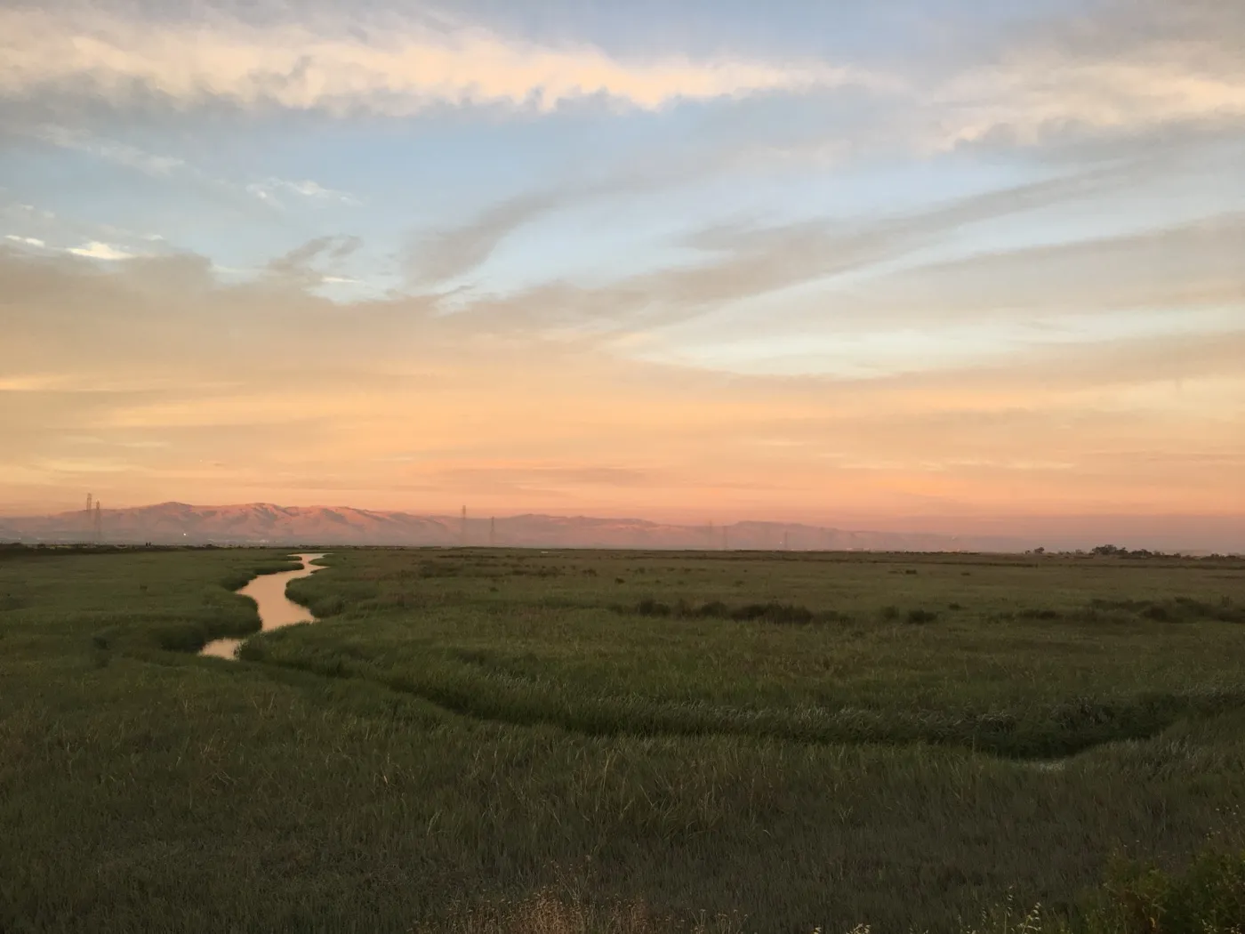
The land around present-day East Palo Alto was long inhabited by the Ohlone people. In 1849, San Francisco banker Isaiah Churchill Woods settled at what is now Cooley Landing, built a home, dairy, and wharf, and named the surrounding area Ravenswood, aiming to make it a major shipping town on San Francisco Bay. After his investments failed, Woods sold the wharf in 1868 to Lester Phillip Cooley, who leased the land to a brick-manufacturing firm. By the early 20th century the surrounding area had grown into a farming community.
East Palo Alto incorporated as a city on July 1, 1983, as part of San Mateo County, and Barbara Mouton was elected its first mayor. Cooley Landing, the site of the original 1849 Ravenswood wharf, is preserved today as a city park within the Ravenswood Open Space Preserve and remains one of the area's oldest landmarks.
East Palo Alto by the numbers
A neutral demographic snapshot from the most recent U.S. Census Bureau American Community Survey. These are city-wide figures; individual neighborhoods and parcels vary.
| Measure | Value |
|---|---|
| Population | 29,143 |
| Median age | 34.2 years |
| Median household income | $104,832 |
| Homeownership rate | 47.9% |
| Median home value (owner-occupied) | $1,124,000 |
| Median gross rent (monthly) | $2,209 |
| Average commute to work (one way) | 25.2 minutes |
| Average household size | 3.49 people |
Source: U.S. Census Bureau, American Community Survey 2019-2023 5-year estimates, East Palo Alto city, California.
The East Palo Alto market right now
| Median sale price | $980,000 |
|---|---|
| Days on market | 37 |
| Homes for sale (inventory) | 30 |
| Homes sold | 4 |
| Sale-to-list | 104% |
Data: Redfin, May 2026
For broader Bay Area context behind the East Palo Alto numbers, read the current Bay Area market note.
What this means for you (May 2026)
Only 4 homes sold in East Palo Alto in May, and they sat for a median 37 days before closing at 104% of asking. That's a market with limited but selective demand: when the right buyer appears, homes still command a premium. The longer time on market gives you room for thorough inspections and careful evaluation before making an offer.
Property taxes in East Palo Alto
Property tax in East Palo Alto starts with San Mateo County's 1% base under Proposition 13 (California's 1978 law capping the base rate and limiting how fast assessed value climbs), plus voter-approved bond debt. For fiscal year 2025-26 the total ad valorem rate (the value-based portion) is 1.11910%. The verified parcel is a low-basis home, so on a representative roughly $1.0M East Palo Alto home the bill runs about $12,943 per year, an effective rate of about 1.29%.
The biggest charges are EPA GARBAGE SVC $802.32 and EPA SANI DISTRICT $660.00. Alongside them sit RAVENSWOOD MEAS Q PTAX $234.08 (the Ravenswood school parcel tax, a flat per-property levy) and EPA LOC STORM WATER $20.14, for a total of $1,752.02 (Ravenswood City Elementary and Sequoia Union High).
Garbage and sanitary-district charges are the biggest lines, plus the Ravenswood Measure Q parcel tax. See how California property tax works, and use the true monthly cost calculator to estimate a specific home. Figures come from a representative single-family county bill (FY 2025-26); every parcel differs, so check the actual bill for any home you are weighing. Compare all 38 cities side by side on the Bay Area property tax map. This is educational, not tax or legal advice; confirm any figure with a qualified tax professional and the county assessor before relying on it.
Schools (Ravenswood City SD + Sequoia Union HSD)
Ravenswood City School District (K-8) serves around 2,800 students (down from 4,500 in 2008-09 due to enrollment decline and charter migration); covers East Palo Alto plus a slice of eastern Menlo Park. Sequoia Union High School District handles 9-12; after the 2014 boundary revision, all Ravenswood SD students are assigned to Menlo-Atherton High School (U.S. News #229 California), the same high school that serves Atherton and central Menlo Park.
Ravenswood is among the more economically challenged K-8 districts on the Peninsula. K-8 demographics differ markedly from neighboring Menlo Park City SD or PAUSD. The K-8 to Menlo-Atherton High transition is a notable change in school setting for EPA students: Menlo-Atherton serves Atherton, central Menlo Park, and East Palo Alto from a single comprehensive high school, with a mix of socio-economic backgrounds that buyers should understand before assuming any single demographic profile. Many EPA households also pursue charter alternatives (Aspire Charter, KIPP) or private school options for K-8.
Typical assignment by sub-area
| Sub-area | Elementary feeders | Middle | High |
|---|---|---|---|
| Central East Palo Alto (Ravenswood core) | Costaño / Belle Haven / Brentwood Academy | Cesar Chavez Ravenswood Middle | Menlo-Atherton High |
| Westside Park / newer master-planned | Costaño / Brentwood Academy | Cesar Chavez Ravenswood Middle | Menlo-Atherton High |
| Woodland Park | Belle Haven / Costaño | Cesar Chavez Ravenswood Middle | Menlo-Atherton High |
| Cooley Landing / east side | Costaño / Brentwood Academy | Cesar Chavez Ravenswood Middle | Menlo-Atherton High |
Ravenswood SD has notable charter alternatives (Aspire Charter, KIPP) plus private options many EPA households pursue at the K-8 level. The Menlo-Atherton High assignment at 9-12 applies to all Ravenswood-area addresses post-2014 boundary revision. Lily verifies the elementary assignment with the Ravenswood registrar before any offer.
Highlight schools
- Menlo-Atherton High School (Sequoia Union HSD, 9-12), U.S. News #229 California; the primary high school for East Palo Alto post-2014; serves a mixed socio-economic catchment from Atherton, central Menlo Park, and East Palo Alto.
- Cesar Chavez Ravenswood Middle School (Ravenswood SD, 6-8), the primary in-district middle feeder.
- Costaño Elementary School (Ravenswood SD, K-5), central East Palo Alto.
- Belle Haven Elementary School (Ravenswood SD, K-5), the Belle Haven (Menlo Park edge) area attendance.
Sources: Ravenswood City School District; Sequoia Union HSD; U.S. News Menlo-Atherton; Ravenswood SD Wikipedia.
Hospitals and birthing centers
East Palo Alto has no in-city hospital, but the Stanford catchment is immediate. Lucile Packard Children's Hospital Stanford (Palo Alto, ~5-10 min across US-101) is the de facto in-corridor flagship with a Level IV NICU. Kaiser members go to Kaiser Redwood City (~10-15 min). Proximity to Stanford means EPA residents have the same Level IV NICU access as Palo Alto residents; the hospital catchment quality is higher than the K-8 ranking suggests.
| Hospital | Network | Drive time from East Palo Alto | Key services |
|---|---|---|---|
| Lucile Packard Children's Hospital Stanford (Palo Alto) | Stanford (PPO) | 5-10 min | Level IV NICU (40 beds); high-risk obstetrics + neonatology + pediatric specialists 24/7; 4,500+ births / year |
| Stanford Hospital | Stanford (PPO) | 5-10 min | Adult Level I Trauma Center; full medical specialties; co-located with Lucile Packard |
| Kaiser Permanente Redwood City Medical Center | Kaiser (closed) | 10-15 min | Full Kaiser L&D (above 34 weeks); transfers premature below 34 weeks to Kaiser Santa Clara or Kaiser SF NICU |
| Sequoia Hospital (Redwood City) | Dignity (PPO) | 10-15 min | Alternative PPO L&D; well-baby + special care nursery |
Birthing centers: what matters
Lucile Packard Stanford is the default for East Palo Alto PPO buyers: 5 to 10 minutes across US-101, Level IV NICU on-site (the highest care level), 24/7 high-risk obstetrics and neonatology and pediatric specialty coverage. EPA's Stanford-catchment proximity is an underappreciated structural advantage of the city; the hospital access quality matches Palo Alto and Menlo Park.
Kaiser members in East Palo Alto go to Kaiser Redwood City: 10 to 15 minutes north. Full L&D for routine delivery above 34 weeks; premature delivery below 34 weeks transfers to Kaiser Santa Clara or Kaiser SF NICU.
Sequoia Hospital is an alternative Dignity PPO option: 10 to 15 minutes north in Redwood City. Active L&D with well-baby and special care nursery.
Hospital network coverage depends on your insurance plan. Lily does not advise on medical coverage decisions; for in-network confirmation contact your insurer directly. Hospital information above is current as of 2026-05-28 and should be re-verified with each hospital's admissions office before relying on it for a major life decision.
Sources: Lucile Packard L&D; Lucile Packard NICU; Kaiser Redwood City L&D; Sequoia Hospital; California Perinatal Quality Care Collaborative NICU Directory.
Crime, hazards, and ratings
East Palo Alto carries higher-than-average crime exposure and notable flood exposure in shoreline and creek-adjacent tracts, with moderate fire hazard in hillside tracts relative to the broader Bay Area. School ratings reflect the local district's performance bands.
| Category | Rating | Detail |
|---|---|---|
| Crime | property and violent crime both above California average; notable improvement over the 1990s peak but still well above neighboring Palo Alto and Menlo Park | |
| Flood | Notable tracts in Zone AE/AO (along San Francisquito Creek and the baylands); the December 2022 / January 2023 storms caused San Francisquito Creek to overflow into the Woodland Avenue area | |
| Fire | Not in LRA fire hazard zones; flat bayfront city | |
| Earthquake | liquefaction: High to Very High citywide; the majority is bay-mud / marsh fill and along the US 101 / San Francisquito Creek corridor; nearest faults: San Andreas Fault about 5 miles west; Hayward Fault about 15 miles east |
School ratings
Numeric snapshots for the highlight schools above:
| School | GreatSchools | Niche |
|---|---|---|
| Menlo-Atherton High | 8 | A |
| East Palo Alto Academy | 4 | C+ |
| Costaño Elementary | 3 | C |
Environment and infrastructure
Beyond the natural-hazard ratings above, these are the environmental and infrastructure factors buyers ask about most. Each is a city-level summary; confirm the exact parcel before any offer.
| Factor | Detail |
|---|---|
| Gas transmission pipelines | PG&E gas transmission lines (the Milpitas-to-San Francisco Peninsula system that includes Line 132, which ruptured at San Bruno in 2010) serve the area. Per-address proximity in East Palo Alto should be verified on the PHMSA NPMS Public Viewer. |
| Noise (freeway, rail, flight paths) | US-101 bisects the city, and CA-84 / the Dumbarton Bridge approach is at its southern edge; Palo Alto Airport general-aviation traffic overflies the area, and SFO/Dumbarton-corridor aircraft contribute regional overflight noise. |
| Refineries and heavy industry | No refineries; the city has a legacy of light-industrial and waste-handling uses along its bayfront/Ravenswood industrial area, most notoriously the Romic hazardous-waste facility (below). |
| Soil and groundwater contamination | East Palo Alto hosted the Romic Environmental Technologies hazardous-waste recycling/treatment facility, which after years of violations and community pressure was forced to stop accepting waste and effectively closed in 2007; the site remains a defining environmental-justice cleanup case. Additional bayfront-fill and industrial cleanup sites are tracked in state databases. |
| Air quality and wildfire smoke | East Palo Alto is a documented environmental-justice community with elevated CalEnviroScreen pollution-burden scores driven by US-101 traffic, the Dumbarton corridor, historic industrial uses, and bayfront sources; seasonal wildfire smoke adds episodic risk. |
| Wildfire zone and power shutoffs (PSPS) | East Palo Alto is flat bayside land and is not in any CAL FIRE high fire hazard zone; PSPS/wildfire exposure is essentially nil. |
| High-voltage power lines | PG&E's Ravenswood Substation, a major 230kV transmission-level substation, sits in the Menlo Park / East Palo Alto bayfront area and feeds distribution substations serving East Palo Alto and neighboring cities; it lies in the flood-exposed zone the SAFER Bay project is designed to protect. Per-address proximity to lines should be verified. |
| Sea level and shoreline flooding | East Palo Alto's baylands and low-lying neighborhoods (including the Ravenswood / bayfront area and lands along San Francisquito Creek) are among the most sea-level-rise- and flood-exposed on the Peninsula; the city is a focus of regional SLR adaptation and creek flood-control efforts (San Francisquito Creek JPA, BCDC). |
These are city-level summaries from public agencies and are approximate. Pipeline and power-line alignments, contamination parcels, and wildfire zones can differ block by block; verify the exact address with the agency tools linked above and your inspections before you write an offer.
Sources: PHMSA National Pipeline Mapping System; DTSC EnviroStor; State Water Board GeoTracker; EPA Superfund; BAAQMD air data; CAL FIRE Fire Hazard Severity Zones; PG&E PSPS maps; NOAA Sea Level Rise Viewer
Hazard ratings are city-level aggregates from public agencies (FEMA, CAL FIRE, USGS). Specific addresses can carry materially different risk; verify the exact parcel via the FEMA Flood Map Service Center, the CAL FIRE FHSZ viewer, and your insurance carrier before any offer. School ratings vary by year and by metric; the numbers above are point-in-time snapshots, treat them as a starting point and re-verify with the district registrar.
Sources: CrimeGrade.org (crime); FEMA Flood Map Service Center (flood); CAL FIRE FHSZ viewer (fire); USGS earthquake hazards (earthquake); GreatSchools + Niche (school ratings).
Track Record
1 documented East Palo Alto closing, $0.9M local volume. Career-wide: 104 documented closings, $115M+ in total volume, with 91 of 104 on the buyer side, 10 closings in the last 12 months, career range $323K to $3.3M, 5.0-star Zillow average across 38+ reviews. The full transaction record for every Bay Area city Lily has closed in is summarized at the cities index.
Ready to talk about East Palo Alto? Call or text me at 415-910-3958 for a free 30-minute consultation.
104 transactions · $115M+ · 5.0★ Zillow · Cal DRE #02010731
What buying a home in East Palo Alto actually involves
Same fiduciary discipline as on every Lily Garipova representation: read every disclosure end-to-end, model the carrying cost (mortgage + property tax + HOA + insurance), walk the property at multiple times of day, and stay willing to walk you away from a property that does not pencil. East Palo Alto-specific particulars are covered in the FAQ below; verify the Ravenswood SD elementary assignment plus the Menlo-Atherton High catchment (post-2014 boundary applies to all Ravenswood addresses) before any offer. EPA is among the more affordable single-family entry points on the Stanford-adjacent Peninsula.
What selling a home in East Palo Alto involves
Strategic Listing Model applied to East Palo Alto: data-driven comp analysis of the specific East Palo Alto sub-area (central Ravenswood core vs Westside Park newer master-planned vs Woodland Park vs Cooley Landing east side carries a price spread per comparable square footage), pre-listing prep with positive-ROI improvements only, professional staging targeted to the entry-level Peninsula buyer demographic, multi-platform marketing with active bid management, and honest disclosure of every defect.
The Meticulous Protector, applied to East Palo Alto
The methodology behind Lily's 38+ five-star Zillow reviews and strong repeat-and-referral business: read every disclosure line, verify every claim, model every carrying cost, walk every property in person before recommending an offer, document the ethical "no" when the math says no. The East Palo Alto version of that methodology is the same as the Dublin version, the Pleasanton version, the Walnut Creek version, and every other city Lily represents, discipline does not change by city.
East Palo Alto FAQ
What are East Palo Alto price ranges in 2026?
East Palo Alto single-family typically runs $750K to $1.3M for the central and Cooley Landing-side tracts, $1M to $1.6M for the newer / renovated Westside Park tracts, and $900K to $1.4M for the Woodland Park tracts. Condos and townhomes (especially in the newer Newell Pope masterplan) run $600K to $1M. EPA is the most affordable single-family entry point on the Stanford-adjacent Peninsula, often 50 to 70% below comparable Palo Alto pricing for the same square footage and lot size. The June 2018 Tulane Ave closing at $905K is representative of the central single-family band.
East Palo Alto vs Palo Alto, what's the real difference?
Same Stanford-anchored hospital catchment, same regional employer base (Meta and Stanford within a 5-minute drive), but a fundamentally different K-8 district (Ravenswood vs PAUSD) and high school (Menlo-Atherton vs Gunn / Paly). The price difference (50 to 70% below comparable Palo Alto) reflects the K-8 to 9-12 academic district gap and the US-101 freeway as a structural psychological boundary. Buyers willing to weight hospital access and freeway-proximity employer access higher than K-8 district often find EPA underpriced relative to the access mix it actually delivers.
Is East Palo Alto safe?
Honest answer: EPA has improved significantly since the 1990s when it carried a national crime reputation. Current crime statistics put EPA in the median range for San Mateo County cities, comparable to parts of Redwood City and the Belle Haven section of Menlo Park. Lily walks every East Palo Alto property at multiple times of day and weights neighborhood-level conditions block by block; the city-wide statistics do not capture the variance between adjacent streets. Pre-offer due diligence here is more granular than in lower-variance cities like Sunnyvale or San Ramon.
Does Lily Garipova speak Russian for East Palo Alto transactions?
Yes. Russian is Lily's native language. Lily represents Russian-speaking buyers and sellers in East Palo Alto and the broader mid-Peninsula in either English or Russian. Russian-language East Palo Alto page: lilygaripova.com/ru/east-palo-alto-realtor/.
What is Westside Park and how does it differ from the central Ravenswood tracts?
Westside Park is the renovated and newer-built tract on the western side of East Palo Alto adjacent to Menlo Park, typically $1M to $1.6M for single-family in 2026. Stock includes 1990s-2010s tract homes plus heavily-renovated older inventory. The Menlo Park / EPA municipal boundary cuts through portions of the Westside Park area; some addresses appear Menlo Park on USPS lookup but are EPA municipally. The Westside Park premium versus comparable central Ravenswood-tract EPA reflects the newer construction and the proximity to Menlo Park amenity overlap.
What is Woodland Park and what are the rental dynamics?
Woodland Park is the residential area in central EPA along Woodland Avenue, much of which was historically owned and operated by a single corporate landlord (Equity Residential / now various entities) as a large multi-family complex. Several Woodland Park properties have transitioned to mixed ownership models with significant tenant-protection litigation history. Single-family in adjacent blocks runs $900K to $1.4M for 2026. Buyers exploring multi-family or fourplex investment must carefully review the rent-stabilization status, Costa-Hawkins exemption status, and any pending litigation; Lily Garipova reviews each parcel's tenancy record before any income-property offer.
What is Cooley Landing and what does the baylands edge look like?
Cooley Landing is the small bayfront park and environmental education center on the eastern edge of East Palo Alto, the former site of historic salt evaporation ponds. The Bay Trail runs from Cooley Landing north along the EPA shoreline. Single-family in the residential blocks west of Cooley Landing (Bell Street, Kavanaugh Drive, Pulgas Avenue) typically runs $800K to $1.2M for 2026. The baylands edge brings open-space access, occasional wildfire smoke-clearing breeze advantage, and FEMA Zone AE flood exposure that requires lender-required flood insurance on most parcels east of Pulgas Avenue.
How does the Ravenswood City SD K-8 district affect EPA pricing?
Ravenswood City School District serves around 2,800 K-8 students (down from 4,500 a decade ago due to enrollment decline and charter migration). The district is among the most economically challenged on the Peninsula by California Department of Education metrics. The Ravenswood vs PAUSD vs MPCSD gap is the dominant pricing variable for EPA: the same Stanford hospital catchment and same regional employer base yield a 50 to 70% price discount versus Palo Alto driven primarily by the K-8 district difference. Many EPA households pursue charter alternatives (Aspire Charter, KIPP) or private school for K-8.
What is the Menlo-Atherton High School post-2014 boundary and how does it affect EPA buyers?
After the 2014 Sequoia Union HSD boundary revision, all Ravenswood City SD addresses (East Palo Alto and the Belle Haven portion of Menlo Park) assign to Menlo-Atherton High School (U.S. News #229 California), the same high school that serves Atherton and central Menlo Park. The Menlo-Atherton assignment is a meaningful upside variable for EPA buyers: the K-8 challenge in Ravenswood gives way to a strong comprehensive high school with mixed socio-economic catchment. For buyers weighing 13 years of K-12 expectation, the 9-12 transition to Menlo-Atherton High is a material improvement over the K-8 baseline.
How does the IKEA East Palo Alto and Ravenswood 101 retail corridor affect property?
The Ravenswood 101 retail corridor (IKEA East Palo Alto, the Four Seasons Hotel Silicon Valley, the Ravenswood Industrial Park) sits on the eastern edge of EPA near University Avenue and the Bayfront Expressway interchange. The corridor brings strong daytime retail and employment activity, sales tax revenue to the city, and modest evening retail noise to adjacent residential blocks. The Four Seasons Hotel provides a regional luxury landmark. Residential immediately adjacent (the Tulane / Bay / Pulgas neighborhood) typically runs $800K to $1.2M for 2026, with the corridor as a net amenity.
What is the Newell Pope condo and townhome masterplan?
Newell Pope is the newer condo and townhome masterplan adjacent to the EPA / Menlo Park boundary, with 2010s-2020s construction in 2- and 3-bedroom condo and townhome configurations. Pricing typically $600K to $1M for 2026, the most affordable condo entry on the Stanford-adjacent Peninsula. HOA (Homeowners Association) dues vary by building and change over time, so pull the HOA package for the current dues before any offer. SB326 balcony inspection compliance is current; reserve study should be reviewed for any pending assessment. The Newell Pope inventory is a primary first-time-buyer entry point for the Stanford / Meta employee population not yet at single-family budget.
Why is Menlo-Atherton High not the same demographic experience as Atherton itself?
Menlo-Atherton High draws attendance from Atherton, central Menlo Park (MPCSD), west Menlo Park (Las Lomitas), and East Palo Alto and Belle Haven (Ravenswood). The student population is one of the most socio-economically diverse comprehensive high schools in the Bay Area. For EPA students, this means access to a strong AP and IB catalog and a college-prep course sequence; for Atherton students, this means the same combined Menlo-Atherton enrollment and course catalog. Menlo-Atherton High is ranked #229 in California by U.S. News and publishes its AP and IB course catalog publicly.
What is the flood risk for East Palo Alto buyers?
Significant portions of East Palo Alto sit in FEMA flood Zone AE/AO along San Francisquito Creek and the baylands. The December 2022 / January 2023 storms caused San Francisquito Creek to overflow into the Woodland Avenue area; significant single-family was affected. Lender-required flood insurance premiums vary widely by parcel elevation, flood zone, and coverage, so get an actual flood insurance quote for the specific parcel before any offer. The San Francisquito Creek JPA flood-control project is in mid-construction phasing through the late 2020s; pre-construction completion the risk profile is elevated. Pull the parcel-specific FEMA flood map and the SFC JPA construction status before any offer.
What is the seismic and liquefaction profile of East Palo Alto?
Liquefaction risk is High to Very High citywide; the majority of EPA sits on bay-mud and marsh fill along the US-101 / San Francisquito Creek corridor. The San Andreas Fault sits about 5 miles west; the Hayward Fault sits about 15 miles east. The Alquist-Priolo Earthquake Fault Zone overlay does not touch EPA directly. For pre-1980 single-family, soft-story garage retrofit and original sewer lateral replacement are common inspection findings; budget $5K to $15K. Pull the parcel-specific California Geological Survey overlay and the structural inspection report before offer.
What does East Palo Alto rent control mean for investment buyers?
East Palo Alto has had a strong rent stabilization ordinance since 1988 (one of the earliest in California), covering most multi-family of 1995 or older construction. Annual allowable rent increases are CPI-tied with a 10% cap. Just-cause eviction protections apply citywide. Single-family and condos are Costa-Hawkins-exempt from rent stabilization for vacancy decontrol but remain subject to just-cause eviction rules. For investors, this means the rent roll on existing multi-family is at-or-below market with limited mark-to-market opportunity; the cash-on-cash math must be calibrated to actual current rents, not market rents. Lily Garipova reviews the rent roll and tenant rosters for every income property.
What is the Bayfront Expressway and how does it affect daily commute?
Bayfront Expressway (CA-84) is the four-lane arterial connecting US-101 in EPA across the Dumbarton Bridge to Fremont and the East Bay. The Dumbarton Bridge commute (EPA to Fremont, Newark, Union City) typically runs 15 to 30 minutes peak. The Bayfront Expressway itself runs heavily congested in both directions during commute hours; the Willow Road interchange on US-101 backs up south-bound morning and north-bound evening. The reverse Dumbarton commute (EPA to East Bay) is one of the underrated commute patterns on the Peninsula for buyers who work East Bay and want Stanford-catchment hospital access at EPA prices.
Why is Mid-Peninsula Caltrain access not direct from EPA?
East Palo Alto has no Caltrain station; the nearest stations are Palo Alto Caltrain (about 10 minutes south across the bridge) and Menlo Park Caltrain (about 10 minutes northwest). Bus connections via VTA and SamTrans reach Palo Alto Caltrain. The Dumbarton Express bus runs to East Bay. For EPA buyers who need daily Caltrain access, the bus-to-Caltrain commute adds 20 to 30 minutes versus a direct Caltrain walkshed. Buyers commuting to San Francisco often drive to Palo Alto or Menlo Park Caltrain park-and-ride; this is one of the EPA structural commute disadvantages versus mid-Peninsula Caltrain-station cities.
How has EPA gentrified since 2011 and where is the current frontier?
Meta's 2011 move to Menlo Park east-side and the subsequent Stanford research expansion drove a significant gentrification wave through East Palo Alto starting 2013-2014. The Westside Park tract gentrified earliest given proximity to Menlo Park; the central Ravenswood tract followed; the Woodland Park rental cluster has gentrified the most slowly given the rent-stabilization regime. Single-family in EPA roughly tripled in nominal terms 2013 to 2022, then flattened. The current frontier is the Cooley Landing-adjacent eastern blocks and the Bell Street / Kavanaugh corridor; investor and owner-occupant interest is steady but no longer accelerating.
What charter and private school options are available in EPA?
Charter K-8 alternatives within EPA include Aspire East Palo Alto Charter School, KIPP Excelencia Community Prep, and several Ravenswood-authorized charters. East Palo Alto Academy (charter high school) provides a small alternative to Menlo-Atherton High. Private school options nearby include Eastside College Preparatory School (the private college-prep school founded specifically for EPA students, in Newell Road), Living Wisdom School (private K-8 in Palo Alto), and the broader Palo Alto private school options. For Russian-speaking buyers, no Russian-language K-12 option exists in EPA; the closest weekend programs are in Palo Alto and Mountain View.
What is the historical municipal incorporation story of EPA?
East Palo Alto incorporated as a city in 1983, having been an unincorporated San Mateo County area since the 1850s. Despite the name and the immediate Palo Alto adjacency, EPA was historically and remains a separate municipality, with its own city government, school district, fire and police, and a separate municipal history from Palo Alto proper. The city sits in San Mateo County (Palo Alto sits in Santa Clara County); the county line runs along San Francisquito Creek. The municipal separation matters for taxes, services, voting jurisdiction, and disclosure obligations on every transaction.
How does the Four Seasons Hotel and the Sun Microsystems campus history affect commercial property?
The Four Seasons Hotel Silicon Valley (East Palo Alto) is the only Four Seasons on the Peninsula, opened 2006 adjacent to US-101 and the IKEA East Palo Alto. The historic Sun Microsystems campus on University Avenue (now various Meta and Stanford-leased properties) anchors the commercial real estate base. Commercial transaction volume in EPA is low relative to Palo Alto or Menlo Park but the per-square-foot pricing has appreciated meaningfully. The hotel and the corporate-leased commercial buffer reinforce the residential gentrification trajectory; long-term residents trade the noise and traffic for proximity to upscale amenity.
How does EPA property tax structure compare to Palo Alto and Menlo Park?
East Palo Alto property tax base rate is the San Mateo County standard 1.0% under Prop 13, plus local assessments. Total effective rate typically runs 1.10% to 1.22% depending on parcel-specific bond and assessment overlays. Sequoia Union HSD bond assessments add about 0.04% to 0.06%; Ravenswood City SD assessments add another 0.03% to 0.05%. The rate is comparable to Menlo Park and Redwood City. Palo Alto sits in Santa Clara County with a slightly different rate structure but the all-in effective is similar. The cross-county boundary is occasionally a source of confusion at closing; always verify the assessment overlay for the specific APN.
East Palo Alto vs Menlo Park Belle Haven for first-time buyers, what's the comparison?
Belle Haven (the east-of-US-101 portion of Menlo Park, also in Ravenswood SD) carries a premium versus comparable EPA single-family for the Menlo Park municipal address, despite identical Ravenswood K-8 and Menlo-Atherton High assignments. Belle Haven gentrified faster than EPA driven by Meta employee proximity. For buyers indifferent to the municipal cache, EPA offers more square footage for the dollar at identical schools. For buyers prioritizing Menlo Park municipal services (parks, library, police) the Belle Haven premium pays for that. The K-12 academic outcome is structurally identical.
How does Lily Garipova represent EPA buyers specifically?
Lily reads every disclosure end-to-end (TDS, NHD, SPQ, HOA package, preliminary title), pulls the parcel-specific FEMA Flood Zone (Zone AE/AO is common), California Geological Survey liquefaction overlay, and the San Francisquito Creek JPA flood-control construction status, verifies the elementary assignment with the Ravenswood registrar by APN, models full carrying cost including mandatory flood insurance where applicable, walks the property at multiple times of day and block by block (variance between adjacent streets is high), and stays willing to recommend walking from a deal that does not pencil. Free 30-minute initial consultation in English or Russian.
How does Lily Garipova represent EPA sellers specifically?
Strategic Listing Model applied at the East Palo Alto sub-area level: comp set drawn from the exact neighborhood (central Ravenswood, Westside Park, Woodland Park, Cooley Landing-side, Newell Pope), not city-wide averages; pre-listing inspection with positive-ROI improvements only; professional staging targeted to the sub-area's actual buyer pool (Meta tech first-time buyer / Stanford academic / regional commuter / investor); multi-platform marketing with active bid management; full disclosure preparation including flood insurance status and rent-stabilization compliance for income property. Bay Area closings in every year since 2017, $115M+ career volume, 1 documented EPA closing at $905K (Tulane Ave, June 2018).
How do I schedule an East Palo Alto consultation with Lily Garipova?
Call or text 415-910-3958, or email lilyagaripova@gmail.com. Free 30-minute initial consultation by phone, Zoom, or in person at any East Palo Alto address that works for you. Available in English and Russian. Cal DRE #02010731. The consultation walks through your specific buying or selling math: budget, timeline, flood zone exposure, K-8 strategy (Ravenswood public vs charter vs private), 9-12 Menlo-Atherton assignment, Stanford hospital catchment access, mortgage pre-approval, and the realistic EPA sub-area that fits.
How has East Palo Alto priced over the trailing 12 months?
East Palo Alto single-family median has been roughly flat over the trailing 12 months ending mid-2026, with Westside Park slightly outperforming (Menlo Park overflow demand) and the rental-heavy Woodland Park cluster underperforming. The Newell Pope condo segment has been mildly negative as SB326 disclosure surfaces deferred-maintenance liabilities and as the broader Peninsula condo segment has softened. Days-on-market has lengthened versus the 2021-2022 peak; the EPA market is more deal-by-deal than comp-driven given block-by-block variance, well-priced and well-prepped listings draw multiple offers, overpriced listings sit.
What is the East Palo Alto Library and University Avenue corridor amenity profile?
The East Palo Alto Library (San Mateo County Library System, at 2415 University Avenue) anchors the central University Avenue corridor with community programming, after-school activities, and meeting space. The University Avenue corridor runs from the US-101 interchange east to the Bayfront Expressway, passing through the IKEA EPA / Four Seasons cluster. Restaurants and small retail cluster near the library and near the Joinville / University intersection. The amenity profile is meaningfully lighter than central Palo Alto or downtown Menlo Park; this is part of the EPA value calibration. Significant new mixed-use is in entitlement phase along University Avenue through the late 2020s.
Is East Palo Alto in San Mateo County and how does the county boundary affect transactions?
Yes. East Palo Alto sits in San Mateo County; Palo Alto sits in Santa Clara County. The county line runs along San Francisquito Creek. The county boundary affects property tax administration (assessor differs), recording fees, transfer tax structure, and county-level disclosure obligations. For cross-creek transactions (EPA buyer selling in Palo Alto, or vice versa) the dual-county handling extends escrow by a few business days. The Sequoia Union HSD spans both counties, the school district boundary is independent of the county boundary. Lily Garipova handles cross-county Peninsula transactions routinely.
What does the EPA ADU and small-multifamily resale market look like?
California ADU law (SB9, AB1033, AB976) applies to East Palo Alto with state preemption of most local restrictions. A permit-issued ADU (Accessory Dwelling Unit, a secondary living unit on the same lot) adds appraised value that varies with size, condition, and unit type, so get a parcel-specific appraisal rather than assuming a figure. 2-4 unit small-multifamily stock concentrates in central EPA and along University Avenue, $1.1M to $2.0M for 2026 depending on unit count, rent roll, and condition. The EPA rent stabilization regime caps mark-to-market on existing multi-family; ADU additions on single-family are uncapped (single-family Costa-Hawkins exempt). House-hacking economics work for owner-occupants who can absorb the ADU buildout cost and capture market-rate ADU rent.