Why Pacifica
Pacifica is not one town but a coastal chain of beach communities strung along Hwy 1, cut off from the rest of the Peninsula by Sweeney Ridge and reached only by the coastal route (Hwy 1) or the inland route (Hwy 280 / 92). Population is around 38,000, spread across Sharp Park / Vallemar in the north, Rockaway Beach / Pedro Point in the center, and Linda Mar in the south, immediately south of Daly City. The schools split the same way the coast does. Pacifica School District handles K-8 and ranks well (2,652 students, state rank top 20%, average testing 9 out of 10), then hands its students to Jefferson Union HSD (headquartered in Daly City) for 9-12, where Terra Nova HS (U.S. News #698 California) and Oceana HS (U.S. News #702 California) sit lower. That step-down is why buyers focused on HS rankings often look at Sequoia Union HSD addresses just to the south for the Carlmont / Menlo-Atherton attendance.
Lily has 1 documented Pacifica closing: 422 Andover Dr at $1.103M (February 2026). Single-family typically runs $900K to $1.5M for the inland tracts (Sharp Park, Park Pacifica), $1.1M to $1.8M for the coastal hillside view tracts (Pedro Point, Linda Mar hillside), and $1.3M to $2M+ for the premium ocean-front and ocean-view Linda Mar coastal tracts, with condos and townhomes at $600K to $1M. Read against the inland Peninsula, those are discounts: often 30 to 50% below comparable single-family per square foot. That gap is the honest tension of Pacifica. You buy the ocean at a coastal premium within the city, and you buy it at a school-district discount against the Peninsula, and the discount is really the market pricing in what the coast costs to live with: fog, salt air, bluff erosion, and the off-coast drives the rest of this page details. Put simply, the Pacifica housing market trades a school-district discount of 30 to 50% below the inland Peninsula for the daily cost of living on the coast.
A short history of Pacifica
The area that became Pacifica has a long recorded history along the San Mateo County coast. On November 4, 1769, a Spanish expedition led by Gaspar de Portola sighted San Francisco Bay from the hills of Sweeney Ridge, which lies within present-day Pacifica. The surrounding lands later formed part of the Rancho San Pedro grant, and the Sanchez Adobe, built in 1846, still stands as the oldest structure in San Mateo County. In the early 1900s, the short-lived Ocean Shore Railroad ran stops along this stretch of coast.
Pacifica was incorporated on November 22, 1957, uniting nine previously separate unincorporated communities: Fairmont, Westview, Pacific Manor, Sharp Park, Fairway Park, Vallemar, Rockaway Beach, Linda Mar, and Pedro Point. The city's name was selected by resident vote. Coastal landmarks include the Pacifica Pier, built in 1973, and Mori Point overlooking the ocean.
Source: Wikipedia: Pacifica, California.
Pacifica by the numbers
A neutral demographic snapshot from the most recent U.S. Census Bureau American Community Survey. These are city-wide figures; individual neighborhoods and parcels vary.
| Measure | Value |
|---|---|
| Population | 37,527 |
| Median age | 44.3 years |
| Median household income | $156,819 |
| Homeownership rate | 68.5% |
| Median home value (owner-occupied) | $1,211,700 |
| Median gross rent (monthly) | $3,080 |
| Average commute to work (one way) | 28.3 minutes |
| Average household size | 2.67 people |
Source: U.S. Census Bureau, American Community Survey 2019-2023 5-year estimates, Pacifica city, California.
The Pacifica market right now
| Median sale price | $1,340,000 |
|---|---|
| Days on market | 16 |
| Homes for sale (inventory) | 50 |
| Homes sold | 25 |
| Sale-to-list | 104% |
Data: Redfin, May 2026
For broader Bay Area context behind the Pacifica numbers, read the current Bay Area market note.
What this means for you (May 2026)
Half the homes on the market in Pacifica sold in May, and the median sale came in at 104% of asking. For buyers, that means listed prices are starting points, not ceilings. Expect to bid above asking, and budget accordingly so there are no surprises when offers come due.
Property taxes in Pacifica
Property tax in Pacifica starts with San Mateo County's 1% base under Proposition 13 (California's 1978 law capping the base rate and limiting how fast assessed value climbs), plus voter-approved bond debt. For fiscal year 2025-26 the total ad valorem rate (the value-based portion) is 1.17740%. The verified parcel is a deeply low-basis home, so on a representative roughly $1.2M Pacifica home the bill runs about $15,604 per year, an effective rate of about 1.30%.
The largest charge is PACIFICA SEWER at $1,036.28. On top sit four school parcel taxes (flat per-property levies): PACIFICA SCH DIST MEA D $118.00, PACIFICA SD MEAS EE $98.00, JUHSD MEASURE Z TAX $95.00, and JUHSD MEASURE Y TAX $58.00, plus SMC MOSQ ABATEMNT ASSMNT $26.02, for a total of $1,475.34 (Pacifica School District and Jefferson Union High).
Pacifica stacks four school parcel taxes on the sewer charge. See how California property tax works, and use the true monthly cost calculator to estimate a specific home. Figures come from a representative single-family county bill (FY 2025-26); every parcel differs, so check the actual bill for any home you are weighing. Compare all 38 cities side by side on the Bay Area property tax map. This is educational, not tax or legal advice; confirm any figure with a qualified tax professional and the county assessor before relying on it.
Schools (Pacifica SD + Jefferson Union HSD)
Pacifica School District (K-8) serves 2,652 students; PublicSchoolReview state rank #344 of 1,907 (top 20%)average testing 9 out of 10. Jefferson Union High School District (JUHSD, 9-12, headquartered in Daly City) operates Terra Nova HS (U.S. News #698 California) and Oceana HS (#702 California) as the two Pacifica high schools; district also includes Jefferson HS and Westmoor HS in Daly City.
K-8 quality is solid mid-tier; 9-12 attainment drops sharply at JUHSD level. Buyers concerned about HS rankings often consider Sequoia Union HSD addresses just to the south (Carlmont, Menlo-Atherton attendance) for the academic step-up, at a significant pricing premium. The Pacifica K-8 to JUHSD 9-12 transition is a noticeable academic step-down compared to the K-8 strength; this is the single biggest school-related variable Pacifica buyers prioritizing schools should weigh.
Typical assignment by sub-area
| Sub-area | Elementary feeders | Middle | High |
|---|---|---|---|
| Sharp Park / Vallemar (north) | Vallemar / Ortega | Ingrid B. Lacy Middle | Terra Nova High |
| Rockaway Beach / Pedro Point (central) | Sunset Ridge | Ingrid B. Lacy Middle | Oceana High or Terra Nova High |
| Linda Mar (south) | Cabrillo / Ocean Shore | Ingrid B. Lacy Middle | Oceana High |
| Park Pacifica (inland east) | Ortega / Vallemar | Ingrid B. Lacy Middle | Terra Nova High |
JUHSD attendance for Pacifica addresses splits between Terra Nova HS (north / central / inland) and Oceana HS (south / Linda Mar). Both are similar tier; the Sequoia Union HSD addresses just south of the Pacifica border (in unincorporated coastal San Mateo County) carry significantly higher-ranked high schools. Lily verifies the exact JUHSD assignment with the district registrar before any offer.
Highlight schools
- Terra Nova High School (JUHSD, 9-12), U.S. News #698 California; serves the north / central / inland Pacifica attendance.
- Oceana High School (JUHSD, 9-12), U.S. News #702 California; serves the southern / Linda Mar attendance.
- Ingrid B. Lacy Middle School (Pacifica SD, 6-8), the single district-wide middle feeder.
- Cabrillo Elementary School (Pacifica SD, K-5), one of the stronger Pacifica SD elementaries; Linda Mar attendance.
Sources: Pacifica School District; Jefferson Union HSD; PublicSchoolReview Pacifica SD; U.S. News Terra Nova; U.S. News Oceana.
Hospitals and birthing centers
Critical caveat for Pacifica buyers who will need labor and delivery: Pacifica has NO in-city hospital with labor and delivery, and the formerly-default North County option closed. Seton Medical Center in Daly City closed its L&D service in 2015. Pacifica families now have no L&D facility in the immediate north county; PPO buyers drive over Sweeney Ridge to Mills-Peninsula Burlingame (~20-30 min via 280 / 92) or into San Francisco (~25-40 min). Kaiser members go to Kaiser Redwood City (~25-35 min) or Kaiser SF (~30-40 min). Buyers who will need labor and delivery should know that ALL labor and delivery requires driving out of the city; this is a real factor to plan around.
| Hospital | Network | Drive time from Pacifica | Key services |
|---|---|---|---|
| Mills-Peninsula Medical Center (Burlingame) | Sutter (PPO) | 20-30 min via 280 / 92 | Sutter Family Birth Center; Level II NICU; the closest Peninsula L&D for Pacifica PPO |
| UCSF Medical Center at Mission Bay (San Francisco) | UCSF (PPO) | 25-40 min | Level IV NICU; Neuro-NICU (first in US); high-acuity SF option |
| Kaiser Permanente Redwood City Medical Center | Kaiser (closed) | 25-35 min | Full Kaiser L&D (above 34 weeks); transfers premature below 34 weeks to Kaiser Santa Clara or Kaiser SF NICU |
| Kaiser Permanente San Francisco Medical Center | Kaiser (closed) | 30-40 min | Alternative Kaiser L&D + on-site NICU |
Birthing centers: what matters
Pacifica is one of the most underserved Bay Area cities for in-corridor L&D. Plan for a 20 to 40 minute drive in any direction for any labor and delivery scenario. Build this into prenatal-care scheduling, particularly for the final weeks of pregnancy. Coastal Hwy 1 closures (occasional landslide closures, especially north of Devil's Slide tunnel) can extend the drive time; the 280 / 92 inland route is the more reliable option in any weather scenario.
For PPO buyersMills-Peninsula Burlingame is the closest Peninsula option (Sutter Family Birth Center, Level II NICU). For high-acuity (Level IV NICU), UCSF Mission Bay in San Francisco is the regional destination.
For Kaiser membersKaiser Redwood City and Kaiser San Francisco are the two closest Kaiser L&D options. Kaiser Redwood City handles routine delivery above 34 weeks; premature below 34 weeks transfers to Kaiser Santa Clara or Kaiser SF NICU.
Hospital network coverage depends on your insurance plan. Lily does not advise on medical coverage decisions; for in-network confirmation contact your insurer directly. Hospital information above is current as of 2026-05-28 and should be re-verified with each hospital's admissions office before relying on it for a major life decision.
Sources: Seton closure SF Examiner; Mills-Peninsula Burlingame; UCSF Birth Center; Kaiser Redwood City; California Perinatal Quality Care Collaborative NICU Directory.
Crime, hazards, and ratings
Pacifica stacks the structural hazards that define the San Mateo coast: the San Andreas Fault comes ashore at Mussel Rock roughly two miles east, the coastal bluffs face active erosion driving managed-retreat actions at the Esplanade and Pacifica State Beach, and the eastern slopes carry Very High and Moderate to High fire hazard. Inland flat tracts behind the beaches carry Moderate liquefaction; landslide risk dominates on the hillsides.
| Category | Rating | Detail |
|---|---|---|
| Crime | property crime near US average; violent crime below California average | |
| Flood | Zone X over the central hillsides; Zone AE along San Pedro Creek and Calera Creek; Zone VE along the immediate Pacific shoreline (Sharp Park, Rockaway Beach, Linda Mar Beach) | |
| Fire | Moderate to High on the eastern coastal-mountain slopes (San Pedro Mountain, Sweeney Ridge, Montara Mountain approaches); Pacifica also faces landslide hazard from saturated coastal slopes during atmospheric rivers (e.g., 2017 Esplanade landslides) | |
| Earthquake | San Andreas Fault about 2 miles east (offshore-to-onshore at Mussel Rock, the fault's San Francisco Peninsula entry point); the city sits closer to a major fault than almost any other in this list; liquefaction: Moderate in flat tracts behind the beaches (Linda Mar valley, Sharp Park flats); landslide susceptibility is the dominant geo-hazard on the hillsides |
School ratings
Numeric snapshots for the highlight schools above:
| School | GreatSchools | Niche |
|---|---|---|
| Terra Nova High | 8 | A- |
| Oceana High | 7 | B |
| Ingrid B. Lacy Middle | 6 | B+ |
Environment and infrastructure
Beyond the natural-hazard ratings above, these are the environmental and infrastructure factors buyers ask about most. Each is a city-level summary; confirm the exact parcel before any offer.
| Factor | Detail |
|---|---|
| Gas transmission pipelines | PG&E gas transmission serves the coastal Peninsula; the Line 132 system that ruptured at San Bruno in 2010 runs inland and to the east of Pacifica rather than along the coast. Per-address proximity should be verified on the PHMSA NPMS Public Viewer. |
| Noise (freeway, rail, flight paths) | CA-1 (Cabrillo Highway) is the dominant traffic-noise source running the length of Pacifica; there is no Caltrain line and the city is largely outside the main SFO over-water arrival/departure corridors, so aircraft noise is comparatively limited. |
| Refineries and heavy industry | No refineries or heavy industry; Pacifica is a residential coastal city with no major stationary industrial emitter. |
| Soil and groundwater contamination | No single notorious Superfund site identified in this research; Pacifica has routine smaller GeoTracker/EnviroStor parcels typical of a built-out city. The dominant land hazard is geologic (bluff erosion/landslides), not chemical contamination. Confirm specific parcels in state databases. |
| Air quality and wildfire smoke | Coastal Pacifica generally has very good air quality thanks to onshore ocean breezes and fog; episodic regional wildfire smoke is the main risk, and coastal marine air typically clears smoke faster than inland valleys. No major local emitter. |
| Wildfire zone and power shutoffs (PSPS) | Pacifica's coastal hills (Santa Cruz Mountains foothills, the Sweeney Ridge / hillside neighborhoods) include CAL FIRE high fire hazard severity zones and carry PG&E PSPS exposure; the immediate coastal flats are lower-risk. Hillside addresses should be checked individually. |
| High-voltage power lines | Regional transmission and local distribution serve the area; no single notorious residential high-voltage corridor is documented in this research. Verify per address. |
| Sea level and shoreline flooding | Pacifica's coastal hazard is OCEAN-side bluff erosion and landslides, not bay tidal inundation: the city has repeatedly lost or red-tagged bluff-top structures (notably the 2010 and 2016 El Nino-driven Esplanade apartment evacuations/demolitions) and is a statewide case study for managed retreat and coastal-bluff erosion under sea level rise. |
These are city-level summaries from public agencies and are approximate. Pipeline and power-line alignments, contamination parcels, and wildfire zones can differ block by block; verify the exact address with the agency tools linked above and your inspections before you write an offer.
Sources: PHMSA National Pipeline Mapping System; DTSC EnviroStor; State Water Board GeoTracker; EPA Superfund; BAAQMD air data; CAL FIRE Fire Hazard Severity Zones; PG&E PSPS maps; NOAA Sea Level Rise Viewer
Hazard ratings are city-level aggregates from public agencies (FEMA, CAL FIRE, USGS). Specific addresses can carry materially different risk; verify the exact parcel via the FEMA Flood Map Service Center, the CAL FIRE FHSZ viewer, and your insurance carrier before any offer. School ratings vary by year and by metric; the numbers above are point-in-time snapshots, treat them as a starting point and re-verify with the district registrar.
Sources: CrimeGrade.org (crime); FEMA Flood Map Service Center (flood); CAL FIRE FHSZ viewer (fire); USGS earthquake hazards (earthquake); GreatSchools + Niche (school ratings).
Track Record
1 documented Pacifica closing, $1.1M local volume. Career-wide: 104 documented closings, $115M+ in total volume, with 91 of 104 on the buyer side, 10 closings in the last 12 months, career range $323K to $3.3M, 5.0-star Zillow average across 38+ reviews. The full transaction record for every Bay Area city Lily has closed in is summarized at the cities index.
Ready to talk about Pacifica? Call or text me at 415-910-3958 for a free 30-minute consultation.
104 transactions · $115M+ · 5.0★ Zillow · Cal DRE #02010731
What buying a home in Pacifica actually involves
Same fiduciary discipline as on every Lily Garipova representation: read every disclosure end-to-end, model the carrying cost (mortgage + property tax + HOA + insurance), walk the property at multiple times of day, and stay willing to walk you away from a property that does not pencil. Pacifica-specific particulars are covered in the FAQ below; the hospital caveat (no in-city L&D, all delivery requires 20-40 min off-coast driving) is essential for buyers who will need labor and delivery; coastal exposure (fog, salt air, ocean-front erosion risk) requires specialized inspection.
What selling a home in Pacifica involves
Strategic Listing Model applied to Pacifica: data-driven comp analysis of the specific Pacifica sub-area (inland Sharp Park / Park Pacifica vs Pedro Point coastal hillside vs Linda Mar ocean-front is a $500K to $1M price-spread per comparable square footage, with the ocean-view tracts at the top), pre-listing prep with positive-ROI improvements only (with attention to coastal-exposure cosmetic refresh: paint, exterior wood, window seals), professional staging targeted to the coastal-lifestyle buyer demographic, multi-platform marketing with active bid management, and honest disclosure of every defect.
The Meticulous Protector, applied to Pacifica
The methodology behind Lily's 38+ five-star Zillow reviews and her strong repeat-and-referral rate: read every disclosure line, verify every claim, model every carrying cost, walk every property in person before recommending an offer, document the ethical "no" when the math says no. The Pacifica version of that methodology is the same as the Dublin version, the Pleasanton version, the Walnut Creek version, and every other city Lily represents, discipline does not change by city.
Pacifica FAQ
What are Pacifica price ranges in 2026?
Pacifica single-family typically runs $900K to $1.5M for inland tracts (Sharp Park, Park Pacifica), $1.1M to $1.8M for the coastal hillside view tracts (Pedro Point, Linda Mar hillside), and $1.3M to $2M+ for the premium ocean-front and ocean-view Linda Mar coastal tracts. Condos and townhomes run $600K to $1M. The February 2026 Andover Dr closing at $1.103M is representative of the inland to coastal-hillside transition tier.
What is the deal with Pacifica hospitals?
Pacifica is one of the most hospital-underserved cities in the Bay Area. There is no in-city hospital with labor and delivery, and Seton Medical Center in Daly City (the formerly-default North County option) closed its L&D service in 2015. All labor and delivery requires driving 20 to 40 minutes off-coast: Mills-Peninsula Burlingame for Sutter PPO, UCSF Mission Bay or CPMC in San Francisco for higher-acuity, Kaiser Redwood City or Kaiser SF for Kaiser members. For buyers who will need labor and delivery this is a real consideration; build the drive into prenatal-care scheduling and plan for the late-pregnancy contingency.
Coastal living, what should I know?
Pacifica's coastal exposure is the lifestyle attraction and the structural cost. The salt air and fog accelerate the wear cycle on exterior paint, wood trim, window seals, and metal fixtures; plan for a more frequent maintenance cycle than inland properties. Coastal bluff and beach-front properties carry erosion risk that requires specialized geotech disclosure review; Esplanade Drive in particular has had documented bluff-erosion property loss in the last 15 years. Lily walks every Pacifica coastal property with the geotech and erosion documentation in mind before recommending an offer.
Does Lily Garipova speak Russian for Pacifica transactions?
Yes. Russian is Lily's native language. Lily represents Russian-speaking buyers and sellers in Pacifica and the broader coastal San Mateo County in either English or Russian. Russian-language Pacifica page: lilygaripova.com/ru/cities/pacifica-realtor/.
What is Linda Mar and why is it the most popular Pacifica neighborhood?
Linda Mar is the south Pacifica neighborhood centered on Linda Mar Boulevard, Crespi Drive, and the Linda Mar Beach valley between Sweeney Ridge and Montara Mountain. It is Pacifica's largest neighborhood and the surf and beach-recreation center, with Linda Mar State Beach, Taco Bell on the beach (a Pacifica landmark), and the Linda Mar Shopping Center. Single-family is $1.1M to $1.8M for inland tracts (1950s and 1960s Doelger tract), $1.5M to $2.2M for hillside view tracts, and $1.8M to $3M+ for the ocean-view bluff homes along Linda Mar Beach. Feeders are Cabrillo or Ocean Shore Elementary, Ingrid B. Lacy Middle, and Oceana High.
What is Sharp Park and what should I know about it?
Sharp Park is the north Pacifica neighborhood centered on Palmetto Avenue, Beach Boulevard, and the Sharp Park Golf Course valley. It is the closest Pacifica neighborhood to Daly City and the most affordable city entry, with single-family typically $900K to $1.3M and a mix of 1940s and 1950s flat-lot tract, modest hillside view homes, and some 1920s coastal cottages. Sharp Park Beach, the Pacifica Pier (a popular fishing pier), and the Sharp Park Golf Course are within walking distance for many homes. Feeders are Vallemar or Ortega Elementary, Ingrid B. Lacy Middle, and Terra Nova High.
What is Park Pacifica and the inland-valley experience like?
Park Pacifica is the inland-east neighborhood tucked into the valley behind Sweeney Ridge, away from the immediate coastline, accessed via Park Pacifica Avenue from Hwy 1. The single-family stock is largely 1950s and 1960s ranch and Doelger tract, $1.0M to $1.5M typical. The inland location means less fog, less salt-air exposure, lower exterior maintenance cycle, and warmer microclimate than the coast-facing neighborhoods, often a 10 to 15 degree summer-afternoon difference. Park Pacifica is the choice for buyers who want Pacifica price levels and coastal access without the day-to-day fog and wind.
What is Pedro Point and Rockaway Beach like?
Pedro Point and Rockaway Beach sit between Sharp Park (north) and Linda Mar (south), with single-family $1.2M to $2M for hillside view tracts and $1.5M to $3M+ for the premium ocean-bluff and Pedro Point Headlands view homes. Pedro Point is the small headland community at the south end of Rockaway, accessed via San Pedro Avenue, with a tight-knit small-town feel. Rockaway Beach holds the Rockaway Quarry redevelopment site and a hotel district. Construction era ranges from 1950s tract to 1970s and 1980s hillside custom. Feeders include Sunset Ridge Elementary, Ingrid B. Lacy Middle, and Oceana or Terra Nova depending on parcel.
What is Vallemar and the eastern foothills experience?
Vallemar is the small north-central neighborhood between Sharp Park and Rockaway Beach, tucked into a coastal valley around Vallemar School. The stock is largely 1940s to 1960s with deeper lots and some equestrian-era character, $1.1M to $1.7M typical. Vallemar Elementary, the local K-8, is one of the stronger Pacifica SD schools and a structural premium driver. The valley microclimate is warmer and less foggy than the coast-facing tracts, similar to Park Pacifica.
What about Pacifica condos and townhomes in 2026?
Pacifica condos and townhomes run $600K to $1M in 2026, with most stock along Palmetto Avenue, Beach Boulevard, and in the Crespi Drive / Linda Mar area. An HOA (homeowners association) sets monthly dues that vary by complex, so pull the current figure and budget from the HOA package rather than assuming. Coastal exposure tends to push exterior maintenance reserves higher, so read the reserve study (the association's funding plan for future major repairs) closely. The California SB 326 inspection cycle (exterior elevated elements on a set inspection schedule) has surfaced reserve and special-assessment exposure for older complexes. Always pull the SB 326 inspection report, reserve study, and 12 months of HOA meeting minutes before offer.
What is the Hwy 1 commute and the inland-route alternative?
Pacifica's only direct access to Hwy 1 runs through the Devil's Slide tunnel (south to Half Moon Bay) and north through Daly City to Hwy 101 or I-280. Pacifica to downtown San Francisco is 25 to 40 minutes via Hwy 1 to I-280, depending on traffic and weather. Atmospheric-river landslide closures of Hwy 1 north of Devil's Slide tunnel have happened multiple times in the last 10 years; the inland 280 / 92 route via San Bruno is the reliable alternative in any weather scenario and is the recommended route for hospital trips and time-sensitive commutes.
What is Pacifica School District and how does it compare to Jefferson Union HSD?
Pacifica School District (K-8) serves 2,652 students, PublicSchoolReview state rank #344 of 1,907 (top 20%), average testing 9 out of 10, solid mid-tier. Jefferson Union HSD (9-12, headquartered in Daly City) operates Terra Nova HS (U.S. News #698 California) and Oceana HS (#702 California) as the two Pacifica high schools. The K-8 to 9-12 transition is a noticeable academic step-down compared to the K-8 strength; this is the single biggest school-related variable Pacifica buyers prioritizing schools should weigh. Sequoia Union HSD addresses just south of the Pacifica border carry significantly higher-ranked high schools at a price premium.
What about the San Andreas Fault and Mussel Rock?
The San Andreas Fault comes ashore at Mussel Rock, approximately two miles east of Sharp Park Beach at the Pacifica / Daly City border. Pacifica sits closer to a major active fault than nearly any other Bay Area city. Liquefaction risk is Moderate in the flat tracts behind the beaches (Linda Mar valley, Sharp Park flats); landslide susceptibility is the dominant geo-hazard on the hillsides, with the 2017 Esplanade Drive landslides as the most prominent recent example. Always pull the parcel-specific California Geological Survey overlay before offer.
What is the Esplanade Drive bluff-erosion situation?
Esplanade Drive sits on the Sharp Park coastal bluff above Pacifica State Beach. Documented bluff erosion over the last 15 years has caused condo and apartment building condemnations, including the 2016 to 2017 yellow-tagging and demolition of multiple oceanfront buildings, and the 2024 partial loss of additional structures. The California Coastal Commission has classified portions of Esplanade as a managed-retreat zone. Lily walks every Esplanade-area listing with the geotech and Coastal Commission documentation in mind; coastal bluff properties anywhere in Pacifica require specialized engineer review before offer.
How does the Pacifica Pier and Sharp Park Golf Course fit into local life?
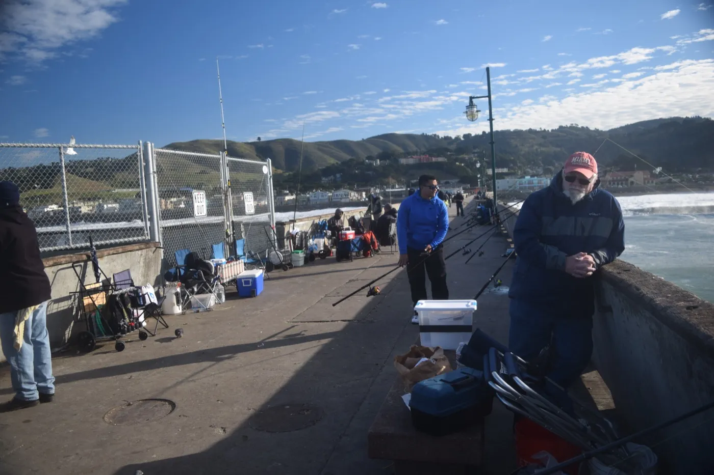
The Pacifica Pier (Sharp Park) is a 1,140-foot ocean fishing pier and a city landmark, one of the few open-to-public oceanfront piers on the San Mateo coast. The Sharp Park Golf Course, designed by Alister MacKenzie (of Augusta National fame) and opened in 1932, runs along the immediate coastline and is San Francisco's only Pacifica-located public course (administered by SF Rec & Park despite the Pacifica location). Both anchor the Sharp Park neighborhood character. Single-family within walking distance of either trades at a structural premium.
What is the surf community like in Pacifica?
Pacifica is a recognized surf town with Linda Mar Beach as the primary year-round break, friendly to beginners and longboarders, and Rockaway Beach, Pacifica State Beach, and Pedro Point as additional spots. NOR-CAL Surf Shop and the local surf-rental and lesson community anchor Linda Mar Beach. The surf-culture buyer pool is real: a meaningful slice of Pacifica purchases are driven by surf-access lifestyle prioritization, particularly for the Linda Mar coastal and bluff-view homes. Surfboard storage, outdoor wetsuit-rinse plumbing, and bike-to-beach access are recurring buyer requests.
What is the Pacifica fog and microclimate situation?
Pacifica sits in the direct path of coastal fog rolling in through the gap between San Bruno Mountain and Sweeney Ridge. Summer (June through September) brings near-daily morning and evening fog along the immediate coast, with afternoon sun typical in the inland valleys (Park Pacifica, Vallemar). Summer-afternoon temperature variation between Linda Mar Beach and Park Pacifica can run 10 to 15 degrees. Winter is milder than inland but wetter; atmospheric-river storms produce most of the year's precipitation in 4 to 8 events. Buyers should walk prospective properties at multiple times of day and in different weather to understand the specific microclimate.
What is the FEMA flood zone situation along the Pacifica coast?
FEMA Zone VE (high-risk coastal wave-action zone) runs along the immediate Pacific shoreline in Sharp Park, Rockaway Beach, and Linda Mar Beach. Zone AE covers San Pedro Creek and Calera Creek lowlands. Zone X (minimal hazard) covers most of the central hillsides and inland tracts. VE zone properties require flood insurance and carry significantly higher premiums than X zone; lenders will require coverage. Pull the parcel-specific FEMA Flood Map Service Center finding before offer; check the most recent map revision date as Pacifica maps have been updated multiple times in the last decade.
What are the Pacifica landslide hazards on the hillsides?
Coastal-mountain landslide susceptibility is the dominant geo-hazard on Pacifica hillsides, particularly during atmospheric-river events. Saturated soils on Sweeney Ridge, San Pedro Mountain, and Montara Mountain approaches have produced recurring landslide events. The 2017 Esplanade Drive landslides and the 1982 Loma Prieta-precursor mudflows are notable. CGS landslide susceptibility maps and individual geotech reports are essential due-diligence items for any Pacifica hillside or upper-bluff parcel. Some lender and insurer underwriting now requires recent (within 5 years) geotech sign-off on identified high-susceptibility parcels.
How does Pacifica compare to Half Moon Bay?
Half Moon Bay sits about 15 miles south of Pacifica on Hwy 1, through the Devil's Slide tunnel and the Montara Mountain coastline. Half Moon Bay is smaller (population ~12,000 vs Pacifica's ~38,000), more agricultural-rural in character, with Cabrillo Unified SD schools (which include the Half Moon Bay High flagship, generally a step up from JUHSD). Pricing in Half Moon Bay runs roughly comparable to Pacifica coastal tracts on the single-family side, sometimes higher on the equestrian and large-lot properties. Coastal commute is longer; some Pacifica buyers also consider Half Moon Bay for the school and lot-size step up.
How does Pacifica compare to Daly City?
Daly City sits directly north of Pacifica across the Mussel Rock fault line, with Hwy 1 running through both. Daly City is in San Francisco Unified County (technically San Mateo County but BART-connected), Jefferson Union HSD shared with Pacifica at 9-12, and Jefferson Elementary SD at K-8 (different from Pacifica SD). Daly City pricing per square foot runs $100 to $200 below comparable Pacifica inland tracts, with the trade-off of denser tract housing, the Doelger-built post-war fog-zone neighborhoods (Westlake, Serramonte), and a more urban character. Daly City has Seton hospital (closed L&D 2015) and BART access (Daly City station).
Should I worry about salt-air corrosion on Pacifica properties?
Yes for any oceanfront, bluff-view, or first-block-from-beach property; modestly for properties within the first mile of coastline. Salt aerosol degrades exterior paint (4 to 6 year repaint cycle vs 8 to 10 inland), corrodes metal window flashings and gutters, attacks exterior wood, and wears down hardware faster than inland. Inspection findings cluster: rusted gutter and downspout systems, deteriorated metal window frames, paint failure on south and west exposures. Stainless or marine-grade hardware, recent exterior paint, and Cor-Ten or similar weathering-steel railings are positive ROI flags on resale. Budget for higher annual maintenance reserves than inland equivalents.
What is the Pacifica ADU situation and rental dynamics?
California ADU (accessory dwelling unit, a secondary home on the same lot) laws apply in Pacifica, and the City of Pacifica has a permit-friendly ADU program. Existing permitted ADUs add appraised value and support house-hacking; on the larger Linda Mar and Pedro Point lots, ADU conversion of existing detached garages or basements is feasible. Achievable rent varies by unit, condition, and location, so get an actual rent quote for the specific property rather than relying on a rule of thumb. Lily Garipova reviews rent roll, permit history, and code-compliance status for every ADU transaction.
How has Pacifica priced over the trailing 12 months?
Pacifica single-family median has been flat to up low-single-digits over the trailing 12 months ending mid-2026. Inland tracts (Sharp Park flat, Park Pacifica, Vallemar) have outperformed coastal-exposure tracts as insurance and erosion-disclosure pressure compresses bluff-view premium. The condo segment along Palmetto and Beach Blvd has been flat to mildly negative as SB326 disclosure surfaces deferred-maintenance liabilities. Days on market on well-priced inland listings remain reasonable; coastal-bluff and Esplanade-adjacent listings sit longer pending geotech and insurance clarity.
How does Lily Garipova represent Pacifica buyers specifically?
Lily reads every disclosure end-to-end (TDS, NHD, SPQ, HOA package, preliminary title), pulls the parcel-specific FEMA, CAL FIRE, and California Coastal Commission overlays, models full carrying cost including coastal-exposure maintenance reserve, walks the property at multiple times of day and in different weather conditions, verifies the JUHSD (Terra Nova vs Oceana) attendance assignment by parcel, coordinates hospital-catchment realism for buyers who will need labor and delivery (no in-city L&D), and stays willing to recommend walking from a deal that does not pencil. Free 30-minute initial consultation.
How does Lily Garipova represent Pacifica sellers specifically?
Strategic Listing Model applied at the Pacifica sub-area level: comp set drawn from the exact neighborhood (Linda Mar vs Sharp Park vs Park Pacifica vs Pedro Point is a $400K to $1M+ price-spread per comparable square footage, with coastal-bluff premium at the top), pre-listing inspection with positive-ROI improvements (coastal-exposure cosmetic refresh: paint, exterior wood, window seals), professional staging targeted to the coastal-lifestyle buyer demographic, multi-platform marketing with active bid management, full disclosure preparation. Bay Area closings in every year since 2017, $115M+ career volume.
How do I schedule a Pacifica consultation with Lily Garipova?
Call or text 415-910-3958, or email lilyagaripova@gmail.com. Free 30-minute initial consultation by phone, Zoom, or in person at any Pacifica address. Available in English and Russian. Cal DRE #02010731. The consultation walks through your specific Pacifica buying or selling math: budget, timeline, school constraints, off-coast commute math, hospital-catchment realism for labor-and-delivery access, coastal-exposure maintenance reserve, and the realistic Pacifica sub-area that fits.
What about Pacifica city character, retail, and downtown?
Pacifica is structurally a coastal chain of beach communities with no single downtown; retail and dining cluster at Linda Mar Shopping Center (south), the Rockaway Beach hotel district (central), and Manor Plaza on Palmetto / Beach Blvd (north). Sharp Park hosts the Pacifica Performances arts venue and the historic Sanchez Library. Linda Mar holds the city's largest grocery, restaurant cluster, and surf-rental shops. Daily errands typically combine multiple neighborhood nodes; long drives to Daly City Westlake Shopping Center or San Bruno for larger retail are common. The lack of a central downtown is structural, not a phase.
How does Pacifica property tax actually work?
Pacifica property tax is governed by California Proposition 13: the 2026 base rate is 1.0% of assessed value plus voter-approved bonds and special assessments, typically 1.10 to 1.20% total. Assessed value is set at purchase price and reassesses only on sale or major improvement (capped at 2% annual base increase). Pacifica carries city, San Mateo County, school district, and various utility bonds on the property tax bill as overrides (voter-approved bond and parcel-tax add-ons above the 1% base rate); the override total varies parcel to parcel, so read it off the actual bill. Mello-Roos is a separate special tax levied inside a CFD (Community Facilities District) to fund infrastructure; whether a given Pacifica parcel carries one varies, so confirm it on the county property tax bill and the seller Mello-Roos Notice of Special Tax rather than assuming there is none. Pull the parcel-specific tax bill from the San Mateo County Assessor before modeling carrying cost.